Marietta in Washington County, Ohio — The American Midwest (Great Lakes)
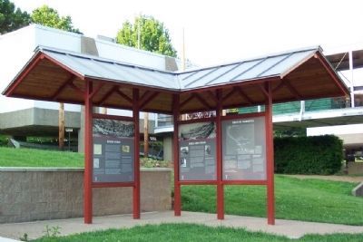
River Town / Sails and Steam / The Highway West
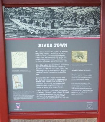
"The settlement of the Ohio country, sir, engrosses many of my thoughts... and if I am to form an opinion on what I have seen and heard on the subject, there are thousands in this quarter who will emigrate to that country." - Rufus Putnam in a letter to President George Washington, 1784
When Rufus Putnam and several fellow Revolutionary War veterans established the Ohio Company of Associates in 1786, they had a grand vision. They were going to buy up a vast amount of land and create the center of the American empire of the west.
Putnam and the Ohio Company were not alone. The Northwest Ordinance of 1787 had opened the territory north and west of the Ohio River to settlement. The scramble was on among land speculators, each competing to create new commercial centers in the western frontier.
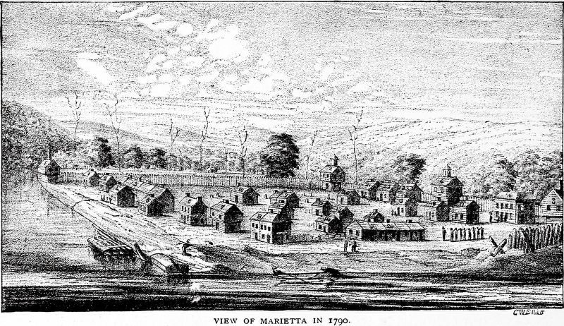
In 1788, Putnam led 47 men to the site of present day Marietta. Although it never achieved the hoped-for commercial prominence, the area grew. As merchants set up businesses and water traffic increased, Marietta established itself as a river town.
From Agriculture to Industry
Apples, pork, and grain from here were shipped to New Orleans and then to ports in the east. The speed of river travel allowed Marietta cargo to beat many inland competitors to market.
As the machine tool industry grew in cities like Cincinnati and Wheeling, grindstones were shipped out of Marietta area quarries in the 1820s. Machinists preferred the coarse-grained stones found in the area. These stones were huge, reaching up to 7 feet in diameter and sometimes weighing more than 3 tons.
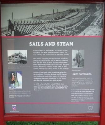
Marietta began as a wilderness settlement located more than 300 miles from the nearest ocean. Its first industry: the construction of sea-going vessels.
With forests supplying material and the Ohio River linking the village to the Gulf of Mexico, Marietta's first ship was built in 1800. As more vessels were built, the industry and Marietta flourished. President Thomas Jefferson's embargo on sea trade in 1807 marked the end of this brief period of ship building.
Marietta's boat yards later turned their attention to steamboats. Both the Whitney yard in Harmar and the Mitchell yard at the mouth of the Little Muskingum River were established in the 1820s, each turning out one or two boats a year.
In 1832, a house builder named William Knox opened his own boat yard. Over the next 55 years, more than 75 steamboats were launched from the Knox yard.
Lafayette Comes to Marietta
When President Monroe invited Marquis de Lafayette to the a “Guest of the Nation,” the Revolutionary War hero was transported up the Ohio River on a Marietta-built steamer called the Mechanic.
Unfortunately, the Mechanic hit a snag and began to sink with Lafayette and his party aboard. The boat's captain hurried his renowned passengers ashore where they spent a dark night along the river bank. The group was rescued by a passing steamboat and eventually continued the journey upriver, stopping in Marietta.
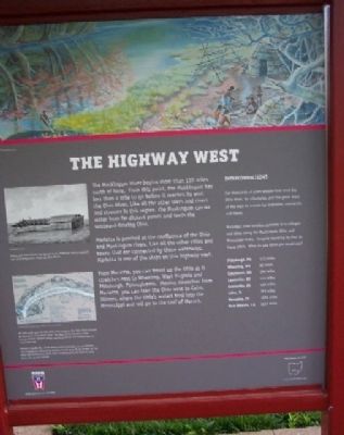
The Muskingum River begins more than 110 miles north of here. From this point, the Muskingum has less than a mile to go before it reaches its end: the Ohio River. Like all the other lakes and rivers and streams in this region, the Muskingum carries water from far-distant points and feeds the westward-flowing Ohio.
Marietta is perched at the confluence of the Ohio and Muskingum rivers. Like all the other cities and towns that are connected by these waterways, Marietta is one of the stops on this highway west.
From Marietta, you can travel up the Ohio as it stretches east to Wheeling, West Virginia and Pittsburgh, Pennsylvania. Moving downriver from Marietta, you can take the Ohio west to Cairo, Illinois, where the Ohio's waters feed into the Mississippi and roll on to the Gulf of Mexico.
Interconnections
For thousands of years people have used the Ohio River, its tributaries,
and the great rivers of the west as a route for migration, commerce, and travel.
Marietta's river location connects it to villages and cities along the Muskingum, Ohio, and Mississippi rivers. Imagine traveling by river to these cities. What do you think you would see?
Pittsburgh, PA 172 miles
Wheeling, WV 82 miles
Cincinnati, OH 298 miles
Louisville, KY 431 miles
Evansville, IN 560 miles
Cairo, IL 783 miles
Memphis, TN 1026 miles
New Orleans, LA 1667 miles
Erected by The Ohio Historical Society.
Topics and series. This historical marker is listed in these topic lists: Industry & Commerce • Waterways & Vessels. In addition, it is included in the Former U.S. Presidents: #05 James Monroe series list. A significant historical year for this entry is 1784.
Location. 39° 25.231′ N, 81° 27.788′ W. Marker is in Marietta, Ohio, in Washington County. Marker is on the grounds of the Ohio River Museum, 601 Front Street. Touch for map. Marker is in this post office area: Marietta OH 45750, United States of America. Touch for directions.
Other nearby markers. At least 8 other markers are within walking distance of this marker. Mighty River / Learning the River (here, next to this marker); Flood Heights (a few steps from this marker); The Towboat W. P. Snyder Jr. (a few steps from this marker); Life on the River / Boats on the Ohio
(a few steps from this marker); The W. P. Snyder Jr. (a few steps from this marker); Tour of the Snyder (a few steps from this marker); Oldest Pilothouse (a few steps from this marker); Oweva Engine (a few steps from this marker). Touch for a list and map of all markers in Marietta.
Credits. This page was last revised on March 1, 2021. It was originally submitted on August 16, 2009, by William Fischer, Jr. of Scranton, Pennsylvania. This page has been viewed 1,281 times since then and 36 times this year. Photos: 1, 2, 3, 4. submitted on August 16, 2009, by William Fischer, Jr. of Scranton, Pennsylvania. 5. submitted on February 24, 2021, by Allen C. Browne of Silver Spring, Maryland. • Bill Pfingsten was the editor who published this page.
