Midtown - Downtown in Columbia in Richland County, South Carolina — The American South (South Atlantic)
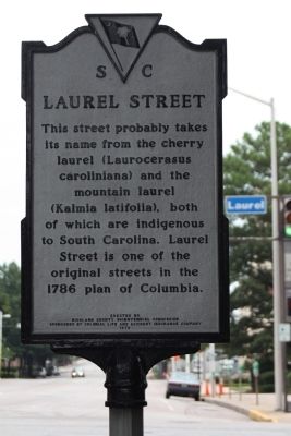
Laurel Street
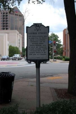
This street probably takes its name from the cherry laurel (Laurocerasus caroliniana) and the mountain laurel (Kalmia latifolia), both of which are indigenous to South Carolina. Laurel Street is one of the original streets in the 1786 plan of Columbia.
Erected 1978 by Richland County Bicentennial Commission Sponsored By Colonial Life and Accident Insurance Co. (Marker Number 40-73.)
Topics. This historical marker is listed in these topic lists: Horticulture & Forestry • Roads & Vehicles. A significant historical year for this entry is 1786.
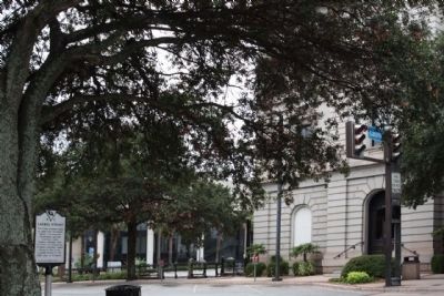
Location. 34° 0.549′ N, 81° 2.202′ W. Marker is in Columbia, South Carolina, in Richland County. It is in Midtown - Downtown. Marker is at the intersection of Main Street and Laurel Street, on the right when traveling north on Main Street. Touch for map. Marker is in this post office area: Columbia SC 29201, United States of America. Touch for directions.
Other nearby markers. At least 10 other markers are within walking distance of this marker. Columbia City Hall (within shouting distance of this marker); The Walls Came Tumbling Down (within shouting distance of this marker); Jefferson Hotel (about 400 feet away, measured in a direct line); Ladson Presbyterian Church (about 500 feet away); Sidney Park C.M.E. Church (about 500 feet away); Richland Street (about 500 feet away); Blanding Street (about 500 feet away); Cabaniss Building (about 600 feet away); Seegers-Habenicht Building (about 600 feet away); Lever Building (about 800 feet away). Touch for a list and map of all markers in Columbia.
Also see . . .
1. Prunus caroliniana. Prunus caroliniana, known as the Carolina Cherry Laurel, with syns. Cherry Laurel, Carolina Cherry, Laurelcherry or Wild Mock Orange, is a flowering tree native to the Southeastern United States, from North Carolina south to Florida and westward to eastern Texas. (Submitted on September 13, 2011, by Brian Scott of Anderson, South Carolina.)
2. Kalmia latifolia. Kalmia latifolia, commonly called Mountain-laurel or Spoonwood, is a species of flowering plant in the blueberry family, Ericaceae, that is native to the eastern United States. (Submitted on September 13, 2011, by Brian Scott of Anderson, South Carolina.)
Credits. This page was last revised on February 16, 2023. It was originally submitted on August 22, 2009, by Mike Stroud of Bluffton, South Carolina. This page has been viewed 809 times since then and 13 times this year. Photos: 1, 2. submitted on August 22, 2009, by Mike Stroud of Bluffton, South Carolina. 3. submitted on September 13, 2011, by Brian Scott of Anderson, South Carolina. 4. submitted on August 22, 2009, by Mike Stroud of Bluffton, South Carolina. • Craig Swain was the editor who published this page.


