Kent in Putnam County, New York — The American Northeast (Mid-Atlantic)
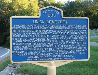
Union Cemetery
Established 1863
Two acres purchased, surveyed and dedicated for burials of early area families. Located just south of Foshay’s Corners on the Old Dutchess Turnpike (now Route 301) on lands of Foshay and Halstead farms, incorporated May 28, 1868 as Union Cemetery Association. Ezekiel K. Merritt, Joseph Haight, George Foshay, Henry C. Light, John A. Bennett, John Halstead, and Isaac Bennett were chosen as the first board of trustees. In 1873 some removals, from three graveyards now covered by the waters of Boyds Reservoir, were interred here. In 1921, more land was bought and surveyed. From this time was commonly known as Union & Halstead Cemetery. A portion was used for other early families. By 1991 an unused part was opened to the public. A meditation garden was added in 1999.
Erected 2000 by Union Cemetery Association.
Topics. This historical marker is listed in this topic list: Cemeteries & Burial Sites. A significant historical date for this entry is May 28, 1924.
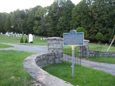
Location. 41° 28.803′ N, 73° 46.109′ W. Marker is in Kent, New York, in Putnam County. Marker is on Carmel-Kent Cliffs Road (New York State Route 301) half a mile south of Cold Spring Turnpike. Touch for map. Marker is in this post office area: Carmel NY 10512, United States of America. Touch for directions.
Other nearby markers. At least 8 other markers are within 4 miles of this marker, measured as the crow flies. Daniel Nimham (approx. 0.7 miles away); One Room School Dist. #3 (approx. 1.9 miles away); Those who Served our Country Buried in Farmers Mills Area Cemeteries (approx. 2.7 miles away); Site of House of Solomon Hopkins (approx. 4 miles away); Putnam County Veterans Monument (approx. 4 miles away); M-60A3 Main Battle Tank (approx. 4 miles away); Cobra AH-1G/S/F Helicopter (approx. 4 miles away); Putnam County's First Park (approx. 4.1 miles away).
Credits. This page was last revised on September 19, 2023. It was originally submitted on September 24, 2009, by Michael Herrick of Southbury, Connecticut. This page has been viewed 1,312 times since then and 42 times this year. Photos: 1, 2. submitted on September 24, 2009, by Michael Herrick of Southbury, Connecticut. • Syd Whittle was the editor who published this page.

