Hanover in York County, Pennsylvania — The American Northeast (Mid-Atlantic)
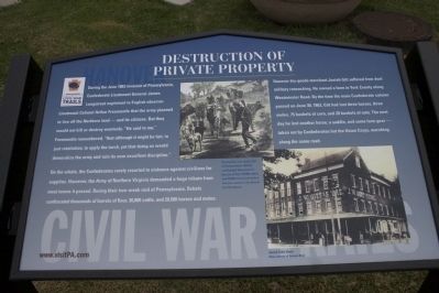
Destruction of Private Property
On the whole, the Confederates rarely resorted to violence against civilians for supplies. However, the Army of Northern Virginia demanded a huge tribute from most towns it passed. During their two-week raid of Pennsylvania, Rebels confiscated thousands of barrels of flour, 30,000 cattle, and 20,000 horses and mules.
Hanover dry-goods merchant Josiah Gitt suffered from dual military ransacking. He owned farms in York County along the Westminister Road. By the time the main Confederate column passed on June 30, 1863, Gitt lost three horses, 75 bushels of corn, and 20 bushels of oats. The next day he lost another horse, a saddle, and some farm gear - taken not by Confederates but the Union Corps, marching along the same road.
Erected 2009 by Civil War Trails.
Topics and series. This historical marker is listed in this topic list: War, US Civil. In addition, it is included in the Pennsylvania Civil War Trails series list. A significant historical month for this entry is June 1863.
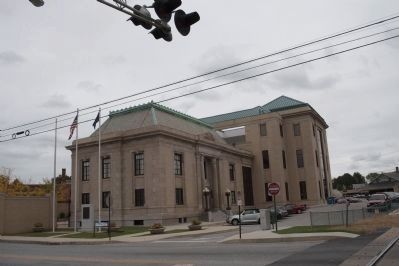
Location. 39° 48.233′ N, 76° 59.217′ W. Marker is in Hanover, Pennsylvania, in York County. Marker is at the intersection of Library Place and Carlisle Street (Pennsylvania Route 94), on the right when traveling west on Library Place. Touch for map. Marker is at or near this postal address: 2 Library Place, Hanover PA 17331, United States of America. Touch for directions.
Other nearby markers. At least 8 other markers are within walking distance of this marker. In Memory and in Grateful Recognition of (a few steps from this marker); This Train is Bound for Glory (about 300 feet away, measured in a direct line); A Commons of Locomotives & Locomotion (about 300 feet away); Working on the Railroad All the Live Long Day (about 300 feet away); Abraham Lincoln (about 500 feet away); Korean War Memorial (about 500 feet away); World War I Memorial (about 500 feet away); Vietnam War Memorial (about 600 feet away). Touch for a list and map of all markers in Hanover.
Credits. This page was last revised on June 16, 2016. It was originally submitted on September 26, 2009, by Henry T. McLin of Hanover, Pennsylvania. This page has been viewed 1,479 times since then and 21 times this year. Photos: 1, 2. submitted on September 26, 2009, by Henry T. McLin of Hanover, Pennsylvania. • Craig Swain was the editor who published this page.

