Alviso in Santa Clara County, California — The American West (Pacific Coastal)
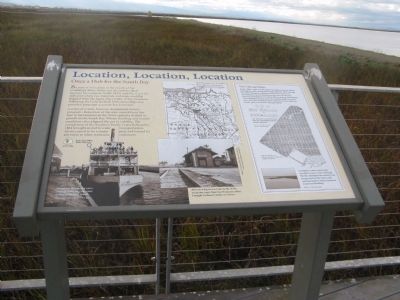
Location, Location, Location
Once a Hub for the South Bay
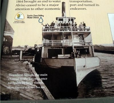
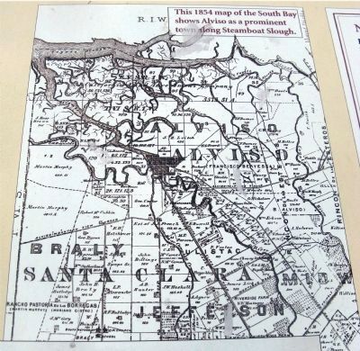
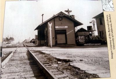
A series of events, however, diminished Alviso’s prospects. Relocation of the state capitol from San Jose to Sacramento in the 1850s caused a decline in growth in the South Bay. Winter flooding and muddy conditions also plagued the port’s viability. The completion of the Southern Pacific Coast Railroad in 1864 brought an end to water transportation. Alviso ceased to be a major port and turned its attention to other economic endeavors.
Erected by Santa Clara County Parks and the Santa Clara Valley Water District.
Topics. This historical marker is listed in these topic lists: Industry & Commerce • Notable Places • Waterways & Vessels. A significant historical year for this entry is 1849.
Location. 37° 25.849′ N, 121° 58.689′ W. Marker is in Alviso, California, in Santa Clara County. Marker can be reached from Hope Street. Marker is on the trail of the Alviso Marina County Park. Touch for map. Marker is in this post office area: Alviso CA 95002, United States of America. Touch for directions.
Other nearby markers. At least 8 other markers are within walking distance of this marker. Salt Ponds (about 300 feet away, measured in a direct line); The Port and Town of Alviso (about 500 feet away); Discover Alviso’s Rich History (about 500 feet away); Water Everywhere (about 500 feet away); The Steamboat Jenny Lind Disaster (about 700 feet away); China Camp (approx. 0.2 miles away); Bayside Cannery (approx. 0.2 miles away); Union Warehouse and Docks (approx. 0.2 miles away). Touch for a list and map of all markers in Alviso.
More about this marker. This trail is part of the San Francisco Bay Trail and the Juan Bautista de Anza National Historic Trail.
Also see . . . Alviso, San Jose. Wikipedia entry. (Submitted on September 7, 2020, by Larry Gertner of New York, New York.)
6. New Chicago Hope
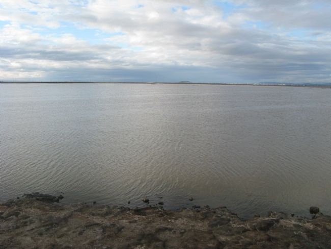
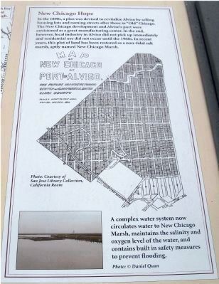
In the 1890s, a plan was devised to revitalize Alviso by selling housing lots and naming the streets after those in “Old” Chicago. The New Chicago development and Alviso’s port were envisioned as a great manufacturing center. In the end, however, local industry in Alviso did not pick up immediately and residential use did not occur until the 1960s. In recent years, this plot of land has been restored as a non-tidal salt marsh, aptly named New Chicago Marsh.
Map
New Chicago
At
Port of Alviso
The future Manufacturing
Center of California, Santa
Clara County
Alviso, March 1890
Photo: Courtesy of San Jose Library Collection, California Room
A complex water system now circulates water to New Chicago Marsh, maintains the salinity and oxygen level of the water, and contains built in safety measures to prevent flooding.
Photo: @ Daniel Quan
Credits. This page was last revised on February 7, 2023. It was originally submitted on November 12, 2009, by Syd Whittle of Mesa, Arizona. This page has been viewed 1,483 times since then and 208 times this year. Photos: 1, 2, 3, 4, 5, 6, 7. submitted on November 12, 2009, by Syd Whittle of Mesa, Arizona.
