Downtown in Baltimore, Maryland — The American Northeast (Mid-Atlantic)
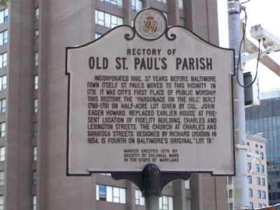
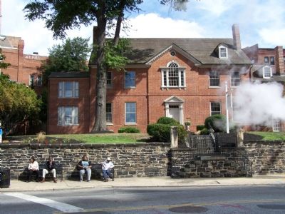
Rectory of Old St. Paulís Parish
Erected 1976 by Society of Colonial Wars in the State of Maryland.
Topics. This historical marker is listed in these topic lists: Churches & Religion • Colonial Era. A significant historical year for this entry is 1692.
Location. 39° 17.588′ N, 76° 36.997′ W. Marker is in Baltimore, Maryland. It is in Downtown. Marker is at the intersection of Cathedral Street and Saratoga Street on Cathedral Street. Touch for map. Marker is in this post office area: Baltimore MD 21201, United States of America. Touch for directions.
Other nearby markers. At least 8 other markers are within walking distance of this marker. Brownís Arcade (about 300 feet away, measured in a direct line); The Latrobe House (about 300 feet away); Creating an American Culture: The Golden Age of Baltimore (about 400 feet away); St. Alphonsus Parish World War II Memorial (about 400 feet away); The Basilica of the National Shrine of the Assumption of the Blessed Virgin Mary (about 400 feet away); James Cardinal Gibbons Monument (about 400 feet away); Votes for Women (about 400 feet away); Brown's Loft Apartments (about 400 feet away). Touch for a list and map of all markers in Baltimore.
Credits. This page was last revised on April 17, 2020. It was originally submitted on September 16, 2007, by Bill Pfingsten of Bel Air, Maryland. This page has been viewed 2,599 times since then and 32 times this year. Photos: 1, 2. submitted on September 16, 2007, by Bill Pfingsten of Bel Air, Maryland. • J. J. Prats was the editor who published this page.

