Hampden Township near Mechanicsburg in Cumberland County, Pennsylvania — The American Northeast (Mid-Atlantic)
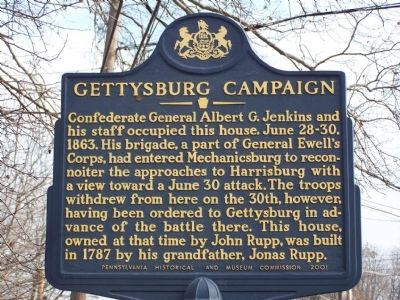
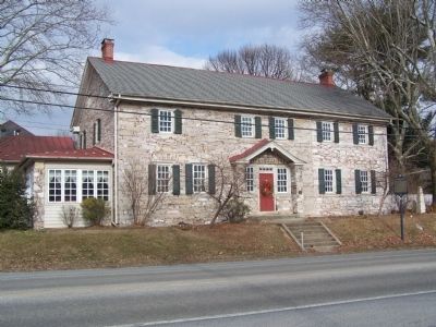
Gettysburg Campaign
Erected by Pennsylvania Historical and Museum Commission.
Topics and series. This historical marker is listed in this topic list: War, US Civil. In addition, it is included in the Gettysburg Campaign, and the Pennsylvania Historical and Museum Commission series lists. A significant historical date for this entry is June 28, 1832.
Location. 40° 13.433′ N, 76° 58.527′ W. Marker is near Mechanicsburg, Pennsylvania, in Cumberland County. It is in Hampden Township. Marker is on Trindle Road. Touch for map. Marker is at or near this postal address: 5115 East Trindle Road, Mechanicsburg PA 17050, United States of America. Touch for directions.
Other nearby markers. At least 8 other markers are within 2 miles of this marker, measured as the crow flies. Sporting Hill (approx. 0.8 miles away); a different marker also named Sporting Hill (approx. 0.8 miles away); a different marker also named Gettysburg Campaign (approx. 0.9 miles away); Peace Church (approx. 1.2 miles away); a different marker also named Peace Church (approx. 1.2 miles away); Irving Female College (approx. 1.4 miles away); Simpson Ferry Road (approx. 1.6 miles away); Frankenberger Tavern (approx. 1.6 miles away). Touch for a list and map of all markers in Mechanicsburg.
Credits. This page was last revised on February 7, 2023. It was originally submitted on January 16, 2010, by Bill Pfingsten of Bel Air, Maryland. This page has been viewed 1,571 times since then and 23 times this year. Photos: 1, 2. submitted on January 16, 2010, by Bill Pfingsten of Bel Air, Maryland.

