Near Surrey in Greater Vancouver, British Columbia — Canada’s West Coast (North America)
Peace Arch
The Signing of the Columbia River Treaty
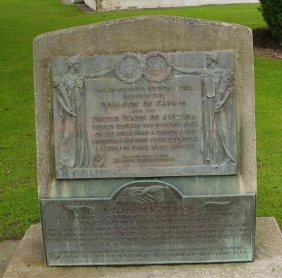
Upper marker:
This unfortified boundary line between the
and the
United States of America
A lesson of peace to all nations.
Lower marker:
The signing of the Columbia River Treaty on September 16th, 1964, at this international peace arch park by the President of the United States, Lyndon B. Johnson, and the Prime Minister of Canada, the Right Honorable Lester B. Pearson, P. C.
Erected and dedicated to continued peace and good will of the peoples of Canada and the United States by Kiwanis International on November 28, 1965,
Erected 1936 by Kiwanis International.
Topics and series. This historical marker is listed in these topic lists: Peace • Roads & Vehicles • Settlements & Settlers • War of 1812. In addition, it is included in the Former U.S. Presidents: #36 Lyndon B. Johnson series list. A significant historical month for this entry is September 1974.
Location. 49° 0.126′ N, 122° 45.374′ W. Marker is near Surrey, British Columbia, in Greater Vancouver. Marker is on 0 Avenue (Interstate 5), on the left when traveling south. This is the West Coast United States/Canada Peace Arch on the National Border. Touch for map. Marker is at or near this postal address: 16800 Peace Park Drive, Surrey BC V3S 9N9, Canada. Touch for directions.
Other nearby markers. At least 8 other markers are within 26 kilometers of this marker, measured as the crow flies. Historic Elgin (approx. 8.9 kilometers away); The Semiahmoo Trail (approx. 9 kilometers away); Historic Port Elgin (approx. 9 kilometers away); Farming History (approx. 9.4 kilometers away); Historic Stewart Farmhouse (approx. 9.4 kilometers away); Historic McMillan Expedition (approx. 11.3 kilometers away); Salmon! (approx. 22.6 kilometers away); The Great Fire (approx. 25 kilometers away). Touch for a list and map of all markers in Surrey.
More about this marker. There is a complex of Peace Arch related properties here, including gardens, a golf course and a British Columbia Regional Park.
Regarding Peace Arch.
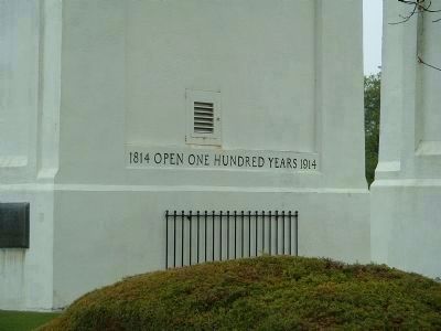
The Peace Arch stands on the international boundary between Blaine, Washington, and Douglas, British Columbia. The Arch was constructed to commemorate the centennial (1814-1914) of the signing of the Treaty of Ghent on December 24, 1814. The Treaty of Ghent ended the war of 1812 between the United States and Great Britain, a conflict
Photographed By Thomas Chris English, April 26, 2006
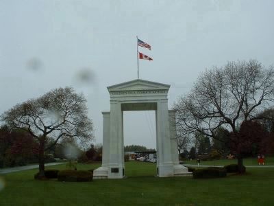
2. Peace Arch
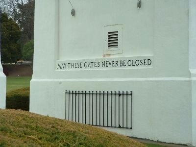
The Canada/U.S. West Coast Peace Arch. The marker is just out of site to the right in this photograph. The lintel on the American side is inscribed, "Children of a Common Mother." The opposite side (not shown) is inscribed: "Brethren dwelling together in unity."
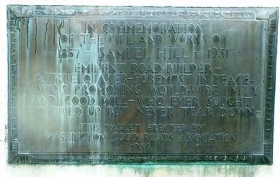
In 1914, the international fund-raising efforts for the Arch were spearheaded by Samuel Hill, famed Washington State lawyer, financier, road builder and humanitarian, who later dedicated it on September 6, 1921. The Arch's design was donated by H.W. Corbett of London, England, an internationally known architect. Automobile clubs in Washington State and British Columbia contributed time and money. Construction began under an international force of volunteers in 1920.
Standing 67 feet high, the Peace Arch is made of concrete and reinforced steel. Its foundation consists of 76 fourteen inch pilings driven 25-30 feet into the earth. The Arch was said to be one of the first structures in North America constructed to be earthquake proof.
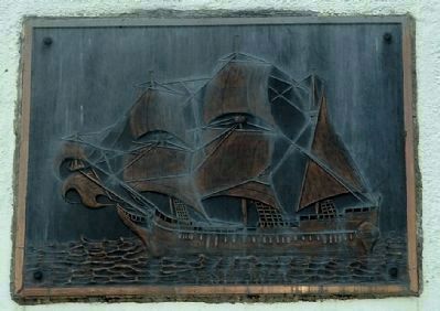
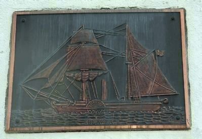
The Arch contains metal caskets in which pieces of the Pilgrim Ship Mayflower and the Canadian Steam Vessel Beaver. Hence there are pictures of each on opposites sides of the Arch.
Additional keywords. British Columbia, Washington State, Douglas B.C., Blaine WA, White Rock B.C.
Photographed By Thomas Chris English, April 26, 2010
5. Mayflower Plaque
Mounted in right column (from South) of the Peace Arch
The Mayflower was the ship that transported the English Separatists, better known as the Pilgrims, from Plymouth, England, to Plymouth, Massachusetts, United States (which would become the capital of Plymouth Colony), in 1620.
The Mayflower was the ship that transported the English Separatists, better known as the Pilgrims, from Plymouth, England, to Plymouth, Massachusetts, United States (which would become the capital of Plymouth Colony), in 1620.
Photographed By Thomas Chris English, April 26, 2010
6. Steam Ship Beaver Plaque
Mounted in Left Column (from South) of the Peace Arch.
Beaver was the first steamship to operate in the Pacific Northwest of North America. She made remote parts of the west coast of Canada accessible for fur trading and was chartered by the Royal Navy for surveying the coastline of British Columbia.
Beaver was the first steamship to operate in the Pacific Northwest of North America. She made remote parts of the west coast of Canada accessible for fur trading and was chartered by the Royal Navy for surveying the coastline of British Columbia.
Photographed By Thomas Chris English, April 26, 2006
7. Nearby Commemoration to the Life and Works of Samuel Hill
This tablet erected by Washington Good Roads Association, 1936
Credits. This page was last revised on August 21, 2020. It was originally submitted on February 13, 2010, by Chris English of Phoenix, Arizona. This page has been viewed 3,598 times since then and 41 times this year. Photos: 1. submitted on April 1, 2010. 2, 3, 4, 5, 6, 7, 8. submitted on February 13, 2010, by Chris English of Phoenix, Arizona. • Kevin W. was the editor who published this page.
