Fresno in Fresno County, California — The American West (Pacific Coastal)
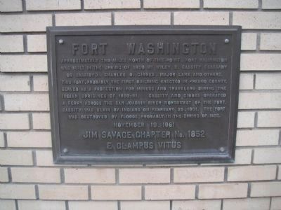
Fort Washington
by Jim Savage Chapter 1852,
E Clampus Vitus
Erected 1961 by E Clampus Vitus, Jim Savage Chapter 1852. (Marker Number 3.)
Topics and series. This historical marker is listed in these topic lists: Forts and Castles • Wars, US Indian. In addition, it is included in the E Clampus Vitus series list. A significant historical date for this entry is November 19, 1878.
Location. 36° 53.133′ N, 119° 45.6′ W. Marker is in Fresno, California, in Fresno County. Marker can be reached from North Millbrook Avenue/Fort Washington Road. One half mile east on the Fort Washington Country Club Access Road. Touch for map. Marker is at or near this postal address: 10272 North Millbrook Avenue, Fresno CA 93730, United States of America. Touch for directions.
Other nearby markers. At least 8 other markers are within 8 miles of this marker, measured as the crow flies. Tarpey Depot (approx. 5.3 miles away); Clovis Veterans Memorial (approx. 5.4 miles away); Christmas Tree Lane (approx. 6 miles away); Sierra Sky Park (approx. 6.9 miles away); Korea "The Forgotten War" (approx. 7.1 miles away); September 11th California Memorial (approx. 7.2 miles away); French Merci Train Boxcar (approx. 7.2 miles away); French Merci Train Boxcar Cover (approx. 7.2 miles away). Touch for a list and map of all markers in Fresno.
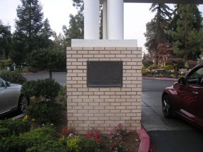
More about this marker. The marker is attached to the one of the white brick columns in front of the Fort Washington Clubhouse
Regarding Fort Washington. This marker is the third of 44 monuments erected by E Clampus Vitus in Fresno County since 1959

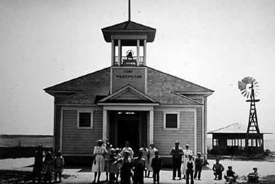
Courtesy of the Eastern Fresno County Museum, 1905
3. Fort Washington School
A school was later built on the site of the old fort. This picture is of the school in 1905. The building was razed when this school was absorbed by the Clovis School district. There is another elementery school now known as Fort Wasington, but it is not located on the historical site.
Credits. This page was last revised on June 16, 2016. It was originally submitted on January 2, 2010, by Lester J Letson of Fresno, California. This page has been viewed 2,377 times since then and 99 times this year. Last updated on February 27, 2010, by Lester J Letson of Fresno, California. Photos: 1, 2. submitted on January 2, 2010, by Lester J Letson of Fresno, California. 3. submitted on August 10, 2010, by Lester J Letson of Fresno, California. • Syd Whittle was the editor who published this page.

