Thomaston in Litchfield County, Connecticut — The American Northeast (New England)
Thomaston
[ front ]
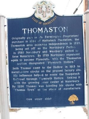
Seth Thomas came to the Hollow in 1813 to manufacture clocks on the present factory site. His influence helped to route the Naugatuck Railroad through Plymouth Hollow, linking it with the growing brass center at Waterbury. By 1856 Thomas was labeling his clocks with "Thomas Town" as the place of manufacture.
[ back ]
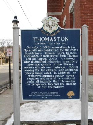
On July 6, 1875, separation from Plymouth was confirmed by the State Legislature. Thomas Town became Thomaston in memory of Seth Thomas and his famous clocks. A century later diversified industries, a sanitary sewerage system, a new library, modern schools and highways, special housing for the elderly, and sectional playgrounds exist. In addition an attractive business center, seven churches and several recreational parks all indicate that Thomaston has progressed beyond the dreams of our forefathers.
Erected by the Town of Thomaston
the Thomaston Historical Society, Inc.
and the Connecticut Historical Commission
1973
Erected 1973 by Town of Thomaston, Thomaston Historical Society, Inc, Connecticut Historical Commission.
Topics. This historical marker is listed in these topic lists: Colonial Era • Settlements & Settlers. A significant historical month for this entry is July 1875.
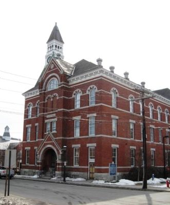
Location. 41° 40.392′ N, 73° 4.51′ W. Marker is in Thomaston, Connecticut, in Litchfield County. Marker is at the intersection of Clay Street and Main Street, on the right when traveling south on Clay Street. Located next to Thomaston Town Hall. Touch for map. Marker is at or near this postal address: 158 Main Street, Thomaston CT 06787, United States of America. Touch for directions.
Other nearby markers. At least 8 other markers are within walking distance of this marker. Thomaston World War I Monument (about 700 feet away, measured in a direct line); Thomaston Soldiers Memorial (about 700 feet away); Thomaston Veterans Monument (about 700 feet away); Thomaston’s Three Tower Clocks (approx. 0.2 miles away); Fr. Michael J. McGivney (approx. 0.2 miles away); Thomaston World War I Memorial (approx. 0.2 miles away); Hillside Cemetery Veterans Memorial (approx. 0.4 miles away); Thomaston Revolutionary Soldiers (approx. half a mile away). Touch for a list and map of all markers in Thomaston.
Credits. This page was last revised on June 16, 2016. It was originally submitted on March 3, 2010, by Michael Herrick of Southbury, Connecticut. This page has been viewed 937 times since then and 10 times this year. Photos: 1, 2, 3. submitted on March 3, 2010, by Michael Herrick of Southbury, Connecticut.


