Sloughhouse in Sacramento County, California — The American West (Pacific Coastal)
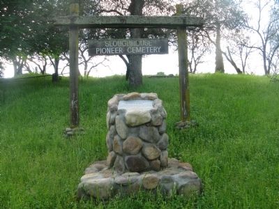
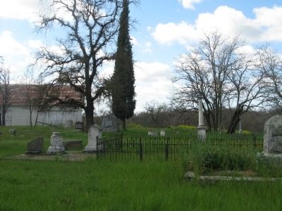
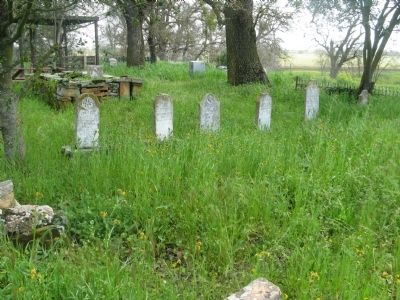
Sloughhouse Pioneer Cemetery
Photographed By Syd Whittle, March 6, 2010
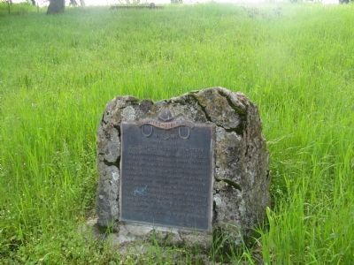
1. Sloughhouse Pioneer Cemetery Marker
In 1971 Percy Westerberg, a descendant of Catherine Rhoedes Sheldon contacted the Daughters of Utah Pioneers about the possiblity of the D.U.P. taking over ownership and permanent care of the cemetery. This would mark the first time that the this land had been divided since the original Mexican land grant in 1842.
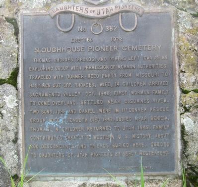
Thomas Rhoades (Rhoads) and others left Iowa as an exploring group with permission of Mormon authorities. Traveled with Donner Reed Party from Missouri to Hastings Cut-off. Rhoades, wife, 14 children arrived Sacramento Valley Oct. 1846, first Mormon family to come overland. Settled near Cosumnes River. Two sons, John and Daniel, were in first Donner rescue group. Wife Elizabeth died 1847 buried near Benicia. Thomas, 4 children returned to Utah 1849. Family contributed greatly to Western U.S. history. About 200 descendants and friends buried here. Deeded to Daughters of Utah Pioneers by Percy Westerberg.
Erected 1972 by Daughters of Utah Pioneers. (Marker Number 382.)
Topics and series. This historical marker is listed in these topic lists: Cemeteries & Burial Sites • Churches & Religion • Settlements & Settlers. In addition, it is included in the Daughters of Utah Pioneers series list. A significant historical year for this entry is 1846.
Location. 38° 29.71′ N, 121° 11.467′ W. Marker is in Sloughhouse, California, in Sacramento County. Marker can be reached from Meiss Road near The Jackson Highway (California Highway 16). Marker is located at the Sloughhouse Pioneer Cemetery. Touch for map. Marker is in this post office area: Sloughhouse CA 95683, United States of America. Touch for directions.
Other nearby markers. At least 8 other markers are within 6 miles of this marker, measured as the crow flies. Jared D. Sheldon (within shouting distance of this marker); John P. Rhoads (within shouting distance of this marker); Sloughhouse (approx. 0.3 miles away); Sheldon Grist Mill (approx. 0.3 miles away); Vernal Pool Grassland (approx. 4.6 miles away); Welcome to Mather Lake (approx. 5.6 miles away); Honor Roll (approx. 5.6 miles away); Mather Air Force Base Navigators Monument (approx. 5.8 miles away). Touch for a list and map of all markers in Sloughhouse.
Also see . . . Thomas Rhoads. California Pioneer Heritage Foundation website entry (Submitted on February 25, 2022, by Larry Gertner of New York, New York.)
Additional commentary.
1. Additional Information on Thomas and Elizabeth Rhoades
Events brought them west:
The Rhoades family had suffered great persecution due to their Mormon beliefs. Their Illinois farm had been attacked and burned, along with several of their neighbor’s farms. Shortly after, they received the blessing from Brigham Young to travel west and settle in California.
They met up with several other groups during their trek west, and traveled for a time with the ill-fated Donner Party. Except for the usual trail hardships, and one skirmish with Indians
Photographed By Syd Whittle, March 6, 2010
2. Sloughhouse Pioneer Cemetery Marker
This historic marker was dedicated in April, 1972. Up until that time the cemetery had been nameless. At the time that the deed was transferred to the D.U.P it was officially named The Slough House Pioneer Cemetery.
(The original spelling of the name was two words. The combining into one word did not occur until recent history.)
(The original spelling of the name was two words. The combining into one word did not occur until recent history.)
The death of Elizabeth:
Elizabeth had borne 19 children, including three pairs of twins, and one set of triplets. She fell ill during the summer of 1947. As medical care was scarce at Sutter’s Fort, Thomas hoped that San Francisco would give her a change in climate and a new doctor. While traveling on a launch down the Sacramento River heading toward San Francisco, she died near Benicia. The launch pulled up to shore and Elizabeth was buried on a hillside. Thomas returned to his home on Dry Creek to tell his children. He had paid a man to place a headboard at her grave and to build a fence around it. It appears that the man did not fulfill his duty, as Thomas returned to the area and could not find her grave.
Source: Historic Cosumnes and The Slough House
Pioneer Cemetery , by Norma B. Ricketts - D.U.P.
— Submitted March 7, 2010.
Photographed By Syd Whittle, March 6, 2010
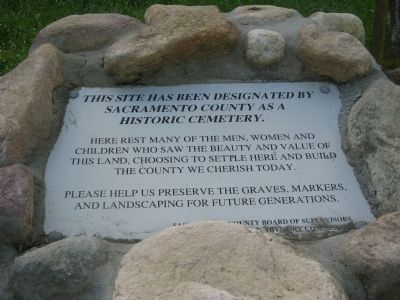
3. Sloughhouse Pioneer Cemetery Historic Cemetery Marker
Sacramento County as a
Historic Cemetery.
Here rest many of the men, women and children who saw the beauty and value of this land, choosing to settle here and build the county we cherish today.
Please help us preserve the graves, markers, and landscaping for future generations.
Sacramento County Board of Supervisors
Sacramento County Cemetery Advisory Commission
Credits. This page was last revised on November 29, 2022. It was originally submitted on March 7, 2010, by Syd Whittle of Mesa, Arizona. This page has been viewed 3,358 times since then and 170 times this year. Last updated on November 1, 2022, by Alvis Hendley of San Francisco, California. Photos: 1, 2, 3, 4, 5, 6. submitted on March 7, 2010, by Syd Whittle of Mesa, Arizona.
