Hamilton in Butler County, Ohio — The American Midwest (Great Lakes)
Rossville Historic District
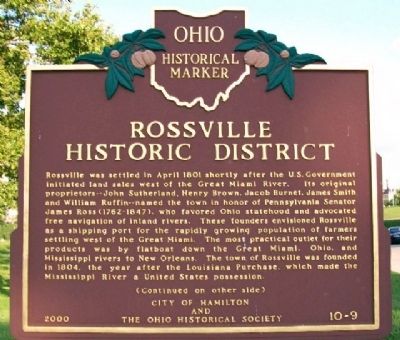
Rossville was settled in April 1801 shortly after the U.S. Government initiated land sales west of the Great Miami River. Its original proprietors--John Sutherland, Henry Brown, Jacob Burnet, James Smith and William Ruffin--named the town in honor of Pennsylvania Senator James Ross (1762-1847), who favored Ohio statehood and advocated free navigation of inland rivers. These founders envisioned Rossville as a shipping port for the rapidly growing population of farmers settling west of the Great Miami. The most practical outlet for their products was by flatboat down the Great Miami, Ohio, and Mississippi rivers to New Orleans. The town of Rossville was founded in 1804, the year after the Louisiana Purchase, which made the Mississippi River a United States possession.
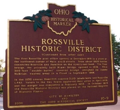
The first Rossville post office opened in December 1819 in a store at the northwest corner of Main and B streets. From about 1805 ferries connected Rossville and Hamilton on the river's east bank. The first bridge, the privately built Miami Bridge, opened in 1819. This 380-foot "double-barrel" covered bridge, designed by James McBride, washed away in a flood in September 1866.
In the 1850 census Hamilton counted 3,210 inhabitants and Rossville 1,447. Voters in the two towns approved their union in April 1854, and the merger was completed in February 1855. In October 1975 the Rossville Historic District was placed on the National Register of Historic Places.
Erected 2000 by City of Hamilton and The Ohio Historical Society. (Marker Number 10-9.)
Topics and series. This historical marker is listed in these topic lists: Bridges & Viaducts • Industry & Commerce • Settlements & Settlers • Waterways & Vessels. In addition, it is included in the Ohio Historical Society / The Ohio History Connection series list. A significant historical month for this entry is February 1855.
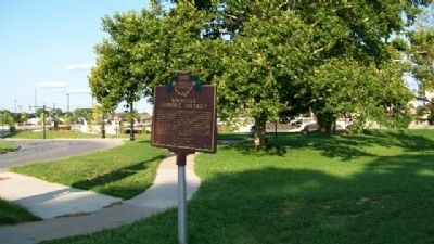
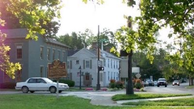
Location. 39° 24.091′ N, 84° 34.062′ W. Marker is in Hamilton, Ohio, in Butler County. Marker is at the intersection of Ross Avenue and B Street, on the right when traveling south on Ross Avenue. Marker is about 50 feet north of the Dr. Henry A. Long [Residence] Tower. Touch for map. Marker is at or near this postal address: 150 S B Street, Hamilton OH 45013, United States of America. Touch for directions.
Other nearby markers. At least 8 other markers are within walking distance of this marker. High-Main Street Bridge (about 400 feet away, measured in a direct line); Earliest Industry (about 400 feet away); The Dream of Hamiltonia (about 500 feet away); Flood & Recovery (about 500 feet away); Hamilton Hydraulic (about 600 feet away); Flatboats and Early Trade (about 600 feet away); Site of Fort Hamilton (about 700 feet away); French Exploration (about 800 feet away). Touch for a list and map of all markers in Hamilton.
Also see . . . Rossville Historic District (Hamilton, Ohio). Wikipedia entry (Submitted on May 2, 2022, by Larry Gertner of New York, New York.)
Credits. This page was last revised on May 2, 2022. It was originally submitted on March 18, 2010, by William Fischer, Jr. of Scranton, Pennsylvania. This page has been viewed 1,734 times since then and 78 times this year. Photos: 1, 2, 3. submitted on March 18, 2010, by William Fischer, Jr. of Scranton, Pennsylvania. 4, 5, 6, 7, 8. submitted on May 13, 2010, by William Fischer, Jr. of Scranton, Pennsylvania.
