Chesterfield in Chesterfield County, Virginia — The American South (Mid-Atlantic)
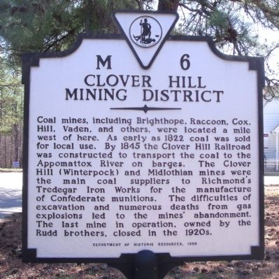
Clover Hill Mining District
Erected 1996 by Department of Historic Resources. (Marker Number M-6.)
Topics and series. This historical marker is listed in these topic lists: Industry & Commerce • Natural Resources • Railroads & Streetcars • War, US Civil. In addition, it is included in the Virginia Department of Historic Resources (DHR) series list. A significant historical year for this entry is 1822.
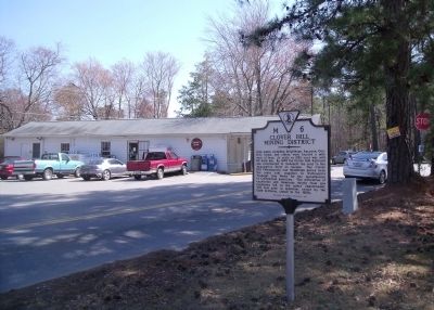
Location. 37° 21.687′ N, 77° 40.787′ W. Marker is in Chesterfield, Virginia, in Chesterfield County. Marker is at the intersection of Winterpock Road (Route 621) and Beach Road (Virginia Route 655), on the right when traveling south on Winterpock Road. Touch for map . Marker is in this post office area: Chesterfield VA 23838, United States of America. Touch for directions.
Other nearby markers. At least 8 other markers are within 7 miles of this marker, measured as the crow flies. Eppington (approx. 3.6 miles away); William Ransom Johnson (approx. 4.8 miles away); CCC Camp Site (approx. 5.6 miles away); Civilian Conservation Corps - Company 2386 (approx. 5.6 miles away); Dividends for the Future (approx. 5.6 miles away); Pocahontas State Park (approx. 5.9 miles away); Piney Grove Church Meeting Site (approx. 6.1 miles away); Eleazar Clay (approx. 6.3 miles away). Touch for a list and map of all markers in Chesterfield.
Also see . . .
1. A short history lesson on Winterpock and Clover Hill. Chesterfield Observer (Submitted on March 21, 2010, by Bernard Fisher of Richmond, Virginia.)
2. Clover Hill, VA Coal Mine Disaster, Apr 1867. (Submitted on March 21, 2010, by Bernard Fisher of Richmond, Virginia.)
Credits. This page was last revised on June 16, 2016. It was originally submitted on March 21, 2010, by Bernard Fisher of Richmond, Virginia. This page has been viewed 2,332 times since then and 57 times this year. Photos: 1, 2. submitted on March 21, 2010, by Bernard Fisher of Richmond, Virginia.

