Harpers Ferry in Jefferson County, West Virginia — The American South (Appalachia)
Capture of Harpers Ferry
No. 3
No. 3
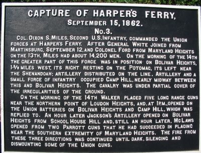
Col. Dixon S. Miles, Second U. S. Infantry, commanded the Union forces at Harpers Ferry. After Gen. White joined from Martinsburg, September 12 and Col. Ford from Maryland Heights on the 13th, Miles had about 14,200 men. On the morning of the 14th, the greater part of this force was in position on Bolivar Heights 15/8 miles west, its right resting on the Potomac, its left near the Shenandoah; Artillery distributed on the line. Artillery and a small force of Infantry occupied Camp Hill, nearly midway between this and Bolivar Heights. The Cavalry was under partial cover of the irregularities of the ground.
On the morning of the 14th Walker placed five long range guns near the northern part of Loudon Heights, and, at 1 P.M., opened on the Union Batteries on Bolivar Heights and Camp Hill, which was replied to. An hour later Jackson's Artillery opened on Bolivar Heights from School House Hill and, still an hour later, McLaws opened from two Parrott Guns that he had succeeded in placing near the southern extremity of Maryland Heights. The fire from these three Divisions was continued until dark silencing and dismounting some of the Union Guns.
Erected by Antietam Battlefield Board. (Marker Number No. 3.)
Topics and series. This historical marker is listed in this topic list: War, US Civil. In addition, it is included in the Antietam Campaign War Department Markers series list. A significant historical month for this entry is September 1951.
Location. 39° 19.377′ N, 77° 43.744′ W. Marker is in Harpers Ferry, West Virginia, in Jefferson County. Marker is on South Potomac Street, on the right when traveling east. Located on just past the railroad overpass, at the overlook to the juncture of the Potomac and Shenandoah Rivers. Touch for map. Marker is in this post office area: Harpers Ferry WV 25425, United States of America. Touch for directions.
Other nearby markers. At least 8 other markers are within walking distance of this marker. A different marker also named Capture of Harpers Ferry (here, next to this marker); a different marker also named Capture of Harpers Ferry (here, next to this marker); a different marker also named Capture of Harpers Ferry (here, next to this marker); a different marker also named Capture of Harpers Ferry (here, next to this marker); John Brown Fort (within shouting distance of this marker); Early Travel (within shouting distance of this marker); The Race to the Ohio (within shouting distance of this marker); The Mule Falters (within shouting distance of this marker). Touch for a list and map of all markers in Harpers Ferry.
Regarding Capture of Harpers Ferry.
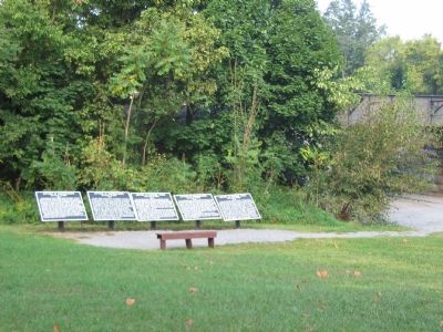
This is one of five tablets at Harpers Ferry describing the action here related to the Battle of Antietam.
Also see . . . 1862 Battle of Harpers Ferry. From the National Parks Service (Submitted on October 11, 2007, by Craig Swain of Leesburg, Virginia.)
Photographed By Craig Swain, September 22, 2007
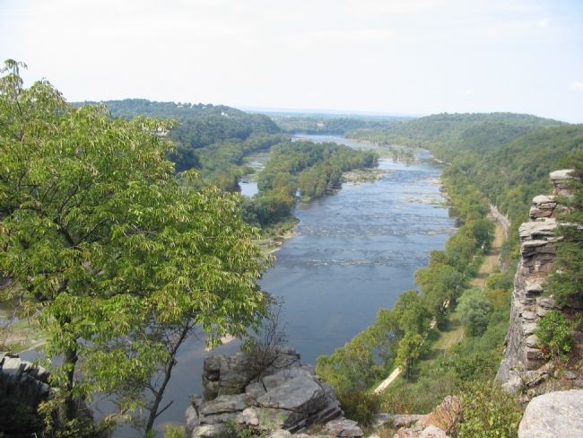
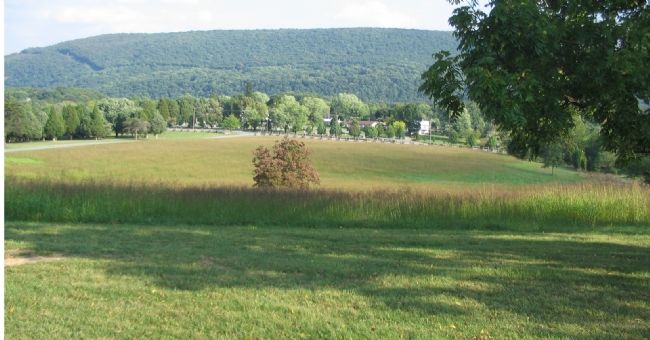
3. From Bolivar Heights Looking at Loudoun Heights
This view clearly demonstrates the disadvantage of the Federal position. From the high ground on Loudoun Heights, as well as from Maryland Heights to the north, the Confederate artillerist had the advantage of elevation.
Photographed By Craig Swain, September 22, 2007
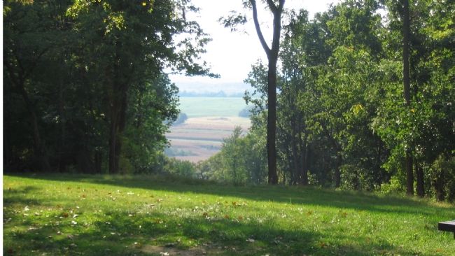
4. From Bolivar Heights Looking at Schoolhouse Ridge
Schoolhouse ridge was recently opened up with interpretive trails by the National Parks Service. Looking down this "cut" one can see the tree line where Jackson's force first advanced against the Harpers Ferry garrison. While Jackson's line didn't have the advantage of elevation, the presence of artillery on that front pinned the Federal forces to Bolivar Heights.
Credits. This page was last revised on June 16, 2016. It was originally submitted on October 11, 2007, by Craig Swain of Leesburg, Virginia. This page has been viewed 1,394 times since then and 16 times this year. Photos: 1, 2, 3, 4, 5. submitted on October 11, 2007, by Craig Swain of Leesburg, Virginia. 6. submitted on August 26, 2011, by Howard C. Ohlhous of Duanesburg, New York.
