Bay Ridge in Brooklyn in Kings County, New York — The American Northeast (Mid-Atlantic)
Denyse’s Ferry – Gravesend Bay
Revolutionary War Heritage Trail
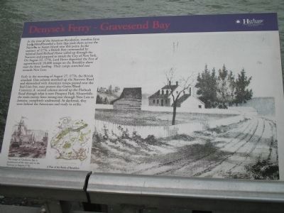
Early in the morning of August 27, 1776, the British attacked. One column marched up the Narrows Road and skirmished with American troops posted near the Red Lion Inn, near present-day Green-Wood Cemetery. A second column moved up the Flatbush Road through what is now Prospect Park. Meanwhile, the main enemy force swung east through New Lots to Jamaica, completely undetected. At daybreak, they were behind the Americans and ready to strike.
Erected by New York State.
Topics. This historical marker is listed in this topic list: War, US Revolutionary. A significant historical year for this entry is 1776.
Location. 40° 36.664′ N, 74° 2.209′ W. Marker is in Brooklyn, New York, in Kings County. It is in Bay Ridge. Marker is on Belt Pkwy, on the right when traveling west. Marker is near the rest area parking lot on the waterfront park under the Veranzano Narrows Bridge. Touch for map. Marker is in this post office area: Brooklyn NY 11209, United States of America. Touch for directions.
Other nearby markers. At least 8 other markers are within walking distance of this marker. The Battle of Brooklyn (here, next to this marker); Inspiratio per exemplum – Inspiration through example (about 500 feet away, measured in a direct line); The Dover Patrol (about 700 feet away); John Paul Jones (approx. 0.2 miles away); Vietnam War Memorial (approx. 0.2 miles away); First Resistance to British Arms in NY (approx. 0.2 miles away); Spanish 24-Pounder (approx. ¼ mile away); 13-inch Seacoast Mortar, Pattern 1861 (approx. ¼ mile away). Touch for a list and map of all markers in Brooklyn.
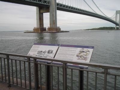
More about this marker. The right of the marker contains a picture of the ferry as it appeared in 1776. It has a caption of “Denyse’s Ferry: The first place at which Hessians and British landed on Long Island August 22nd 1776 – now Fort Hamilton. Emmet Collection, Miriam and Ira D. Wallach Division of Art Prints and Photographs, the New York Public Library, Astor, Lenox and Tilden Foundations.”
The bottom left of the marker features a picture of British ships on the water, and has a caption of “This image of Charleston Bay is reminiscent of the view seen in the Narrows in August 1776. Picture Collection, the Branch Libraries,
the New York Public Library, Astor, Lenox and Tilden Foundations.” Next to this is a map of Brooklyn with the caption “A Plan of the Battle of Brooklyn. This map highlights the approximate location of this historic site.”
Also see . . .
1. The Battle of Long Island, August 27, 1776 at Long Island, New York. The American Revolutionary War website. (Submitted on May 16, 2010, by Bill Coughlin of Woodland Park, New Jersey.)
2. Battle of Long Island, August 27, 1776. (Submitted on May 16, 2010, by Bill Coughlin of Woodland Park, New Jersey.)
3. The Battle of Long Island 1776. A British perspective of the battle from BritishBattles.com. (Submitted on May 16, 2010, by Bill Coughlin of Woodland Park, New Jersey.)
Credits. This page was last revised on January 31, 2023. It was originally submitted on May 16, 2010, by Bill Coughlin of Woodland Park, New Jersey. This page has been viewed 3,599 times since then and 97 times this year. Photos: 1, 2, 3, 4. submitted on May 16, 2010, by Bill Coughlin of Woodland Park, New Jersey.


