Charleston in Charleston County, South Carolina — The American South (South Atlantic)
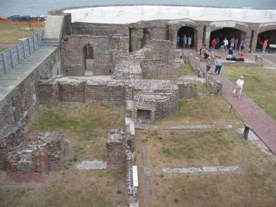
Gorge Wall
Erected by Fort Sumter National Monument, South Carolina - National Park Service - U.S. Department of the Interior.
Topics. This historical marker is listed in these topic lists: Forts and Castles • War, US Civil.
Location. 32° 45.136′ N, 79° 52.501′ W. Marker is in Charleston, South Carolina, in Charleston County. Marker is located at Fort Sumter National Monument and only reached by boat. See links below for more information about access to the site. Touch for map. Marker is in this post office area: Charleston SC 29412, United States of America. Touch for directions.
Other nearby markers. At least 8 other markers are within walking distance of this marker. The Garrison Defending Fort Sumter (here, next to this marker); Battery Huger (a few steps from this marker); Powder Magazine (a few steps from this marker); Fort Sumter 1861-65 (a few steps from this marker); Fort Sumter Today (within shouting distance of this marker); Casemates and Cannon (within shouting distance of this marker); Fort Johnson (within shouting distance of this marker); Charleston Besieged (within shouting distance of this marker). Touch for a list and map of all markers in Charleston.
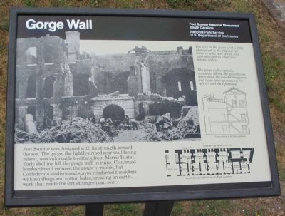
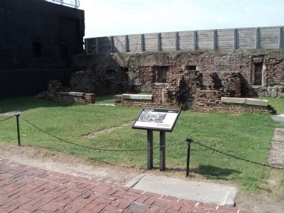
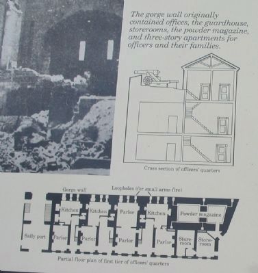
More about this marker. In the center is a wartime photograph showing damage to the wall. The arch in the center of this 1861 photograph is the original fort entry, or sally port, which was later relocated where you entered today. On the right is a cross section of the wall. The gorge wall originally contained offices, the guardhouse, storerooms, the powder magazine, and three-story apartments for officers and their families. At the bottom right is a floor plan of the officer's quarters.
Credits. This page was last revised on September 19, 2020. It was originally submitted on May 19, 2010, by Craig Swain of Leesburg, Virginia. This page has been viewed 1,104 times since then and 61 times this year. Photos: 1. submitted on May 19, 2010, by Craig Swain of Leesburg, Virginia. 2. submitted on August 17, 2013, by Bill Coughlin of Woodland Park, New Jersey. 3, 4, 5. submitted on May 19, 2010, by Craig Swain of Leesburg, Virginia. 6. submitted on September 12, 2020, by Bradley Owen of Morgantown, West Virginia.
