Drakes Branch in Charlotte County, Virginia — The American South (Mid-Atlantic)
Drakes Branch
"Burnt all the depot buildings"
— Wilson-Kautz Raid —
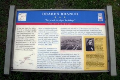
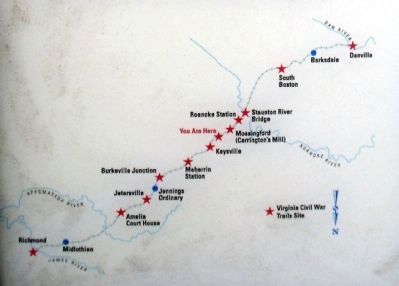
In June 1864, to deny Gen. Robert E. Lee the use of the South Side R.R. and the Richmond and Danville R.R., Gen. Ulysses S. Grant sent Gen. James H. Wilson and Gen. August V. Kautz south of Petersburg on a cavalry raid to destroy track and rolling stock. The main Union force arrived here about 9 A.M. on June 25 and halted for two hours. The Federals continued destroying track from here to present-day Randolph, then known as Roanoke Station.
“Burnt all the depot buildings and works at Drakes Branch… and nearly every saw mill on the line…. [T]hey burnt tobacco houses and corn cribs with their contents but everywhere spared the grist mills at the solicitation of the Negroes.” - Confederate News Report, The Richmond Examiner, July 4, 1864
“I ordered two regiments of the First and two regiments of the Second Brigade to be constantly engaged in tearing up and burning the railroad as far down as Drakes Branch, requiring Chapman to cover the movement with two regiments. The day was excessively hot, and the men were completely exhausted by their continued hard work on the railroad. I was obliged to halt the division at Drakes Branch for three or four hours in order to let the working parties come in and rejoin us. Fortunately, during all this time, we were not molested by the enemy.” - Col. John B. McIntosh, Commander, First Brigade, Wilson’s Division
“Saturday, 25th, marched on up the railroad, reaching Drakes Branch Station at 9 A.M., destroying the road as on previous days; Halted for two hours, then marched on toward Roanoke Station.” - Col. Samuel D. Spears, Commander, Second Brigade, Kautz’s Division
[Sidebar:]
Confederate president Jefferson Davis, members of his Cabinet, and a guard from the Confederate navy to protect the Confederate treasury passed through Drakes Branch on their way to Danville after the evacuation of Richmond on April 2, 1865. Drakes Branch, like so many other communities on the Richmond and Danville R.R., was used as a water and fuel stop. While there is no documentary proof, it is probable that the train stopped in Drakes Branch to refuel before continuing south. Davis assembled the remnants of his government at the Sutherlin Mansion (now a museum) in Danville, making that city the last capital of the Confederacy. Since then, there have been persistent rumors of Confederate gold buried along Davis’s escape route to prevent its capture by Federal forces. Those rumors have become folklore and people continue to hunt for the gold.
Erected by Virginia Civil War Trails.
Topics and series. This historical marker is listed in these topic lists: Railroads & Streetcars • War, US Civil. In addition, it is included in the Virginia Civil War Trails series list. A significant historical date for this entry is April 2, 1865.
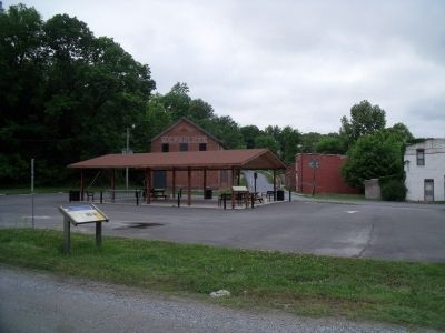
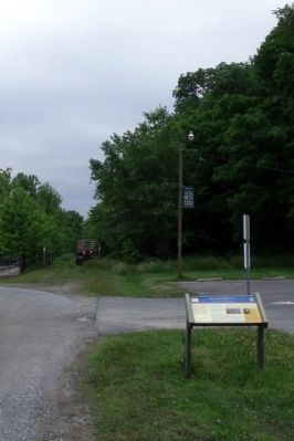
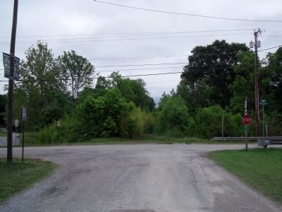
Location. 36° 59.551′ N, 78° 36.068′ W. Marker is in Drakes Branch, Virginia, in Charlotte County. Marker is at the intersection of Depot Street and Drakes Main Street (Virginia Route 47), on the right when traveling south on Depot Street. Touch for map. Marker is in this post office area: Drakes Branch VA 23937, United States of America. Touch for directions.
Other nearby markers. At least 8 other markers are within 5 miles of this marker, measured as the crow flies. Veterans Memorial (approx. ¼ mile away); Vietnam War Memorial (approx. ¼ mile away); Greenfield (approx. 4.7 miles away); Edgehill (approx. 4.7 miles away); Charlotte County Library (approx. 4.8 miles away); Constitutional Oak (approx. 4.8 miles away); Charlotte County Confederate Monument (approx. 4.9 miles away); Henry and Randolph (approx. 4.9 miles away). Touch for a list and map of all markers in Drakes Branch.
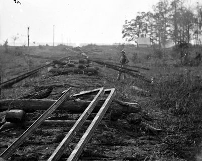
More about this marker. On the center is a photo with the caption, "Destroying railroads included heating and “wrapping” the rails."
The sidebar displays a photo of "Jefferson Davis"
Also see . . .
1. Wilson–Kautz Raid. Wikipedia entry (Submitted on April 16, 2022, by Larry Gertner of New York, New York.)
2. Wilson-Kautz Raid sites. Part of Lee's Retreat Virginia Civil War Trails PDF (Submitted on April 16, 2022, by Larry Gertner of New York, New York.)
3. A brief History of Drakes Branch, Virginia. Town website entry (Submitted on May 21, 2010, by Bernard Fisher of Richmond, Virginia.)
4. The Search for Lost Confederate Gold. By Hans Kuenzi, The Cleveland Civil War Roundtable (Submitted on May 21, 2010, by Bernard Fisher of Richmond, Virginia.)
Credits. This page was last revised on June 1, 2022. It was originally submitted on May 21, 2010, by Bernard Fisher of Richmond, Virginia. This page has been viewed 2,133 times since then and 122 times this year. Photos: 1, 2, 3, 4, 5, 6. submitted on May 21, 2010, by Bernard Fisher of Richmond, Virginia. 7. submitted on April 8, 2012, by Daniel Thomas of Midlothian, Virginia.
