Washington Township near Blue Ridge Summit in Franklin County, Pennsylvania — The American Northeast (Mid-Atlantic)
The Battle of Monterey Pass
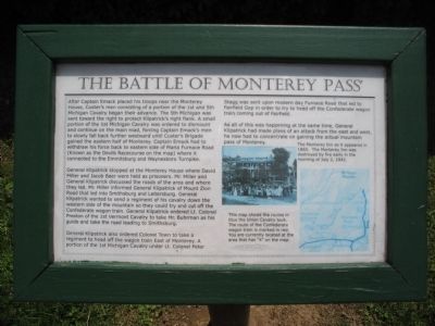
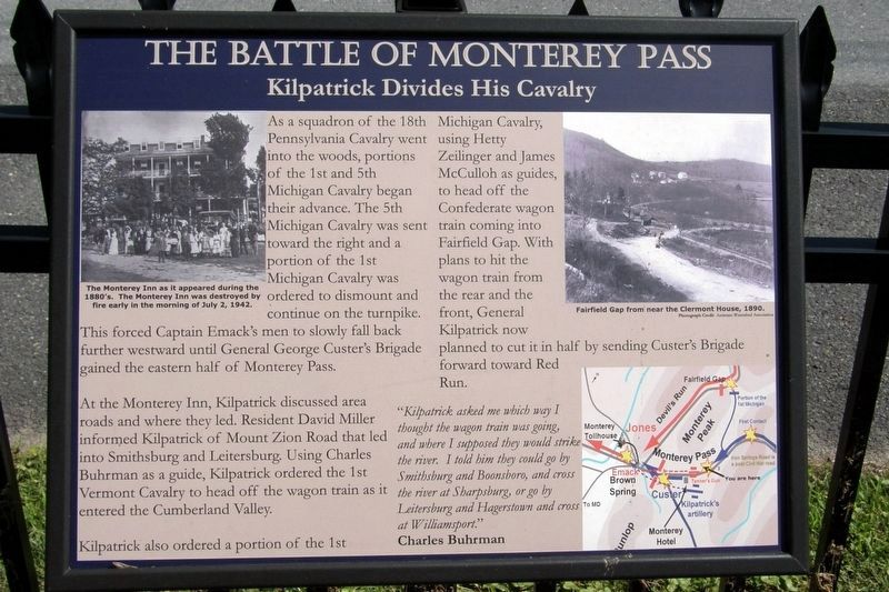
General Kilpatrick stopped at the Monterey House where David Miller and Jacob Baer were held as prisoners. Mr. Miller and General Kilpatrick discussed the roads of the area and where they led. Mr. Miller informed General Kilpatrick of Mount Zion Road that led into Smithsburg and Leitersburg. General Kilpatrick wanted to send a regiment of his cavalry down the western side of the mountain so they could try and cut off the Confederate wagon train. General Kilpatrick ordered Lt. Colonel Preston of the 1st Vermont Cavalry to take Mr. Buhrman as his guide and take the road leading to Smithsburg.
General Kilpatrick also ordered Colonel Town to take a regiment to head off the wagon train East of Monterey. A portion of the 1st Michigan Cavalry under Lt. Colonel Peter Stagg was sent upon modern day Furnace Road that led to Fairfield Gap in order to try to head off the Confederate wagon train coming out of Fairfield.
As all of this was happening at the same time, General Kilpatrick had made plans of an attack from the east and west, he now had to concentrate on gaining the actual mountain pass of Monterey.
Topics. This historical marker is listed in this topic list: War, US Civil.
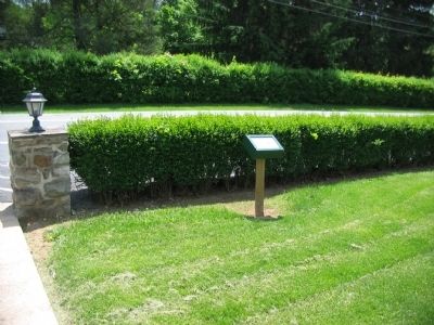
Location. This marker has been replaced by another marker nearby. 39° 44.327′ N, 77° 28.141′ W. Marker is near Blue Ridge Summit, Pennsylvania, in Franklin County. It is in Washington Township. Marker is on Charmian Road, on the right when traveling west. Located in front of the Hawley Memorial Church. Touch for map. Marker is at or near this postal address: 14753 Charmian Rd, Blue Ridge Summit PA 17214, United States of America. Touch for directions.
Other nearby markers. At least 8 other markers are within walking distance of this location. A different marker also named The Battle of Monterey Pass (here, next to this marker); a different marker also named The Battle of Monterey Pass (here, next to this marker); a different marker also named The Battle of Monterey Pass (a few steps from this marker); a different marker also named The Battle of Monterey Pass
(approx. 0.4 miles away); Monterey Academy (approx. 0.4 miles away); a different marker also named The Battle of Monterey Pass (approx. half a mile away); a different marker also named The Battle of Monterey Pass (approx. half a mile away); 10,000 Soldiers Fight at Monterey Pass (approx. half a mile away). Touch for a list and map of all markers in Blue Ridge Summit.
More about this marker. This marker was replaced by a new one also named The Battle of Monterey Pass (see nearby markers).
Also see . . . Monterey Pass Battlefield Association. The association provides many resources including a guide to the battlefield. (Submitted on May 22, 2010, by Craig Swain of Leesburg, Virginia.)
Photographed By Craig Swain, May 15, 2010
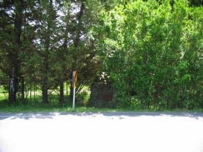
5. David Miller Memorial
Located about 200 yards east of the church were the marker stands, this memorial recalls David Miller mentioned on the marker. It reads:
In rememberance of the kindness
of
David Miller
for thirty five years proprietor of
Clermont
this tablet has been placed
by his neighbors
A.D. 1900
of
David Miller
for thirty five years proprietor of
Clermont
this tablet has been placed
by his neighbors
A.D. 1900
Credits. This page was last revised on February 7, 2023. It was originally submitted on May 22, 2010, by Craig Swain of Leesburg, Virginia. This page has been viewed 1,733 times since then and 16 times this year. Photos: 1. submitted on May 22, 2010, by Craig Swain of Leesburg, Virginia. 2. submitted on May 15, 2017, by Larry Gertner of New York, New York. 3, 4. submitted on May 22, 2010, by Craig Swain of Leesburg, Virginia. 5. submitted on May 23, 2010, by Craig Swain of Leesburg, Virginia.
