Newport in Carteret County, North Carolina — The American South (South Atlantic)
Newport Barracks
Winter Quarters Ablaze
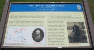
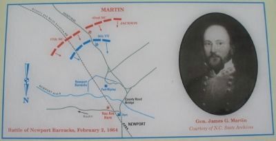
In January 1864, Confederate Gen. James G. Martin's force of almost 2,000 men advanced from Wilmington toward Morehead City to support Gen. George E. Pickett's expedition to recapture New Bern, N.C. On February 2, Martin's Confederates overran nearby Union outposts, then marched toward Newport Barracks. Union Lt. Col. Valentine G. Barney commanded there with Company D, 2nd Massachusetts Heavy Artillery, the 9th Vermont Infantry, and two cavalry companies. The Vermonters deployed south of the barracks to meet the attack.
About 4 p.m. Martin's men, advancing along the county road and railroad, drove the Vermont troops back toward the barracks. The Federal artillery company prematurely abandoned the forts on both sides of the Newport River and retreated. Barney had no choice but to retreat across the river about 6 p.m. after setting the barracks buildings afire. The railroad and road bridges also were burned, and the 9th Vermont retreated to Beaufort. U.S. losses were 5 dead, 10 wounded, and 30 captured, while Confederates lost 6 killed and 14 wounded. Martin's men captured valuable supplies and equipment at the barracks, but on learning of the failure of Pickett's attack on New Bern, they returned to Wilmington.
The old earthworks were demolished in the 20th century.
Erected by North Carolina Civil War Trails.
Topics and series. This historical marker is listed in this topic list: War, US Civil. In addition, it is included in the North Carolina Civil War Trails series list. A significant historical month for this entry is January 1864.
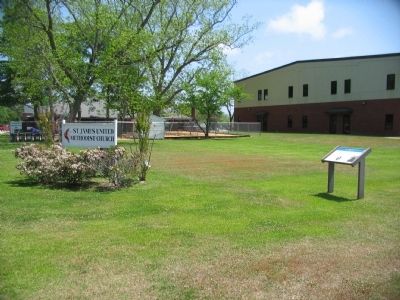
Location. 34° 47.093′ N, 76° 51.477′ W. Marker is in Newport, North Carolina, in Carteret County. Marker is at the intersection of Main Street and East Railroad Boulevard, on the right when traveling east on Main Street. Located at the St. James United Methodist Church. Touch for map. Marker is in this post office area: Newport NC 28570, United States of America. Touch for directions.
Other nearby markers. At least 8 other markers are within 8 miles of this marker, measured as the crow flies. A different marker also named Newport Barracks (approx. 0.6 miles away); Bogue Sound Blockhouse (approx. 3.7 miles away); SS Pevensey (approx. 6˝ miles away); Verrazzano (approx. 6˝ miles away); Cherry Point (approx. 7.2 miles away); N.C. State Highway Patrol (approx. 7.2 miles away); North Carolina National Guard (approx. 7.2 miles away); A United States Naval Section Base Inshore Patrol (approx. 7.3 miles away). Touch for a list and map of all markers in Newport.
More about this marker. On the lower left is a map depicting the action described on the marker. Next to the map is a portrait of Gen. James G. Martin. On the right is a photo of Lt. Col. Valentine G. Barney.
Also see . . . The Newport Barracks. Blog site featuring discussions about the battle. (Submitted on June 7, 2010, by Craig Swain of Leesburg, Virginia.)
Credits. This page was last revised on June 16, 2016. It was originally submitted on May 27, 2010, by Craig Swain of Leesburg, Virginia. This page has been viewed 1,504 times since then and 71 times this year. Photos: 1, 2, 3. submitted on May 27, 2010, by Craig Swain of Leesburg, Virginia.


