Glencoe Village in Burlington in Alamance County, North Carolina — The American South (South Atlantic)
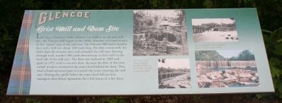
Glencoe - Grist Mill and Dam Site
Topics. This historical marker is listed in this topic list: Industry & Commerce. A significant historical year for this entry is 1909.
Location. 36° 8.434′ N, 79° 25.846′ W. Marker is in Burlington, North Carolina, in Alamance County. It is in Glencoe Village. Marker is on Mill Race Road. Glencoe Village is 3 miles north of Burlington, NC from NC Highway 62. Touch for map. Marker is at or near this postal address: 2698 Mill Race Rd, Burlington NC 27217, United States of America. Touch for directions.
Other nearby markers. At least 8 other markers are within walking distance of this marker. Churches (approx. 0.2 miles away); Working the Shift (approx. 0.2 miles away); Cotton Dust and Poverty (approx. 0.2 miles away); Power, Wheel House and Turbine (approx. 0.2 miles away); The Rise of the Textile Mill Communities (approx. 0.2 miles away); Calling the Mill Village 'Home' (approx. 0.2 miles away); Neighbors Divided (approx. 0.2 miles away); Living in a Mill-Centered World (approx. 0.2 miles away). Touch for a list and map of all markers in Burlington.
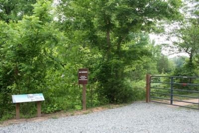
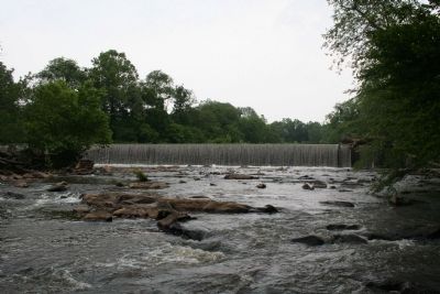
More about this marker. From Glencoe Street, turn onto Sarah Rhyne Road, then right onto Mill Race Road, marker is on your left. Park on the roadside. Be careful not to block the cattle gate or private driveways. Walk around the cattle gate and follow the short walking trail for a view of the old dam and the river.
Additional keywords. Textiles, Burlington, Graham, Alamance
Credits. This page was last revised on May 11, 2023. It was originally submitted on May 31, 2010, by Patrick G. Jordan of Graham, North Carolina. This page has been viewed 1,285 times since then and 27 times this year. Last updated on May 9, 2023, by Michael Buckner of Durham, North Carolina. Photos: 1, 2, 3. submitted on May 31, 2010, by Patrick G. Jordan of Graham, North Carolina. • J. Makali Bruton was the editor who published this page.


