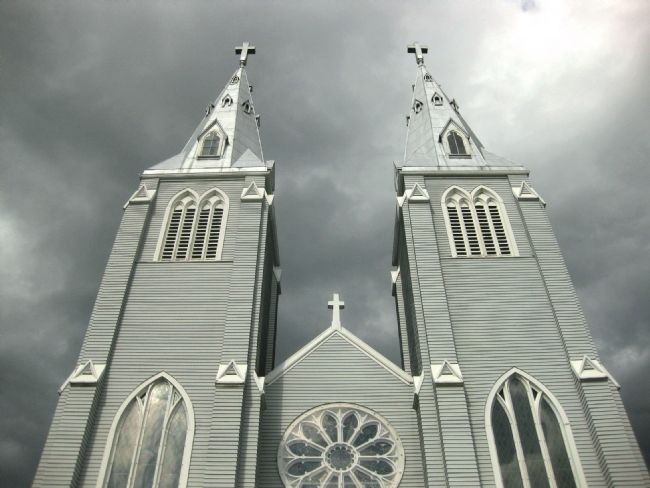
Near North Vancouver in Greater Vancouver, British Columbia — Canada’s West Coast (North America)
St. Paul's Church
L'église Saint-Paul
{In English:}
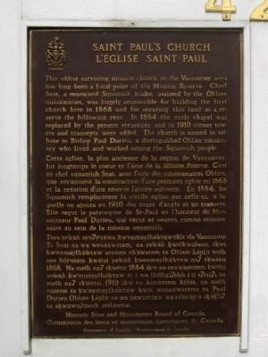
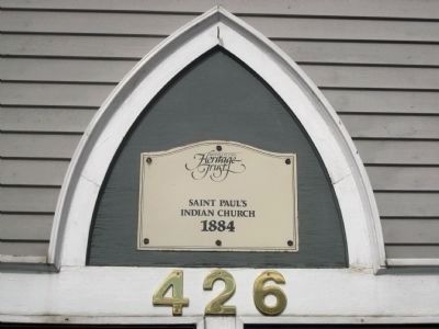
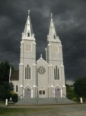
The oldest surviving mission church in the Vancouver area has long been a focal point of the Mission Reserve. Chief Snat, a renowned Squamish leader, assisted by the Oblate missionaries, was largely responsible for building the first church here in 1868 and for securing this land as a reserve in the following year. In 1884 the early chapel was replaced by the present structure and in 1910 corner towers and transepts were added. The church is named in tribute to Bishop Paul Durieu, a distinguished Oblate missionary who lived and worked among the Squamish people.
{In French:}
Cette église, la plus ancienne de la région de Vancouver, fut longtemps le coeur et l’âme de la Mission Reserve. C’est au chef squamish Snat, avec l’aide des missionaire Oblats, que reviennent la construction de une premičre église en 1868 et la crčation de une rčserve l'annče suivante. En 1884, les Squamish remplacerént le vieille église par celle-ci, a la-quelle on ajouta en 1910 des tours d'angle et un transept. Elle reçu le patronyme de Saint-Paul en l'honneur de Monseignor Paul Durieu, qui veçut et oeuvra comme missionaire au sein de la mission squamish.
{In Squamish:}
Tíwa ye’wán syú7yuxwa kw’enmaylháwtxw ch’it tla Vancouver. Ta Snat na wa wenáxwstem, na ye’wán’ kwelkwálwen , tkwi kw’enmaylhá’wtxw sesmen ch’áwatem ta Oblate Léplit wel nes húyutem kwétsi yew’án’ kw’enmaylháwtxw na7 tkwétsi 1868. Na melh na7 tkwétsi 1884 ikw na nexwáyentem kwétsi yew’án’ kw’enmaylháwtxw ti i wa lhihxi7elsh i ti s7tsi7s na melh na7 tkwétsi 1910 ikw na hiviéntem kiv’át, na melh nántem ta kw’enmaylháwtxw kwis wenaxwstems ta Paul Durieu Oblate Léplit na wa uxwumixw wa ts’its’áp’a sk’ek’u7 ta skwxwu7mesh stélmexw.
Commission des lieux et monuments historiques du Canada.
Government of Canada• Gouvernement du Canada
Erected by Historic Sites and Monuments Board of Canada.
Topics. This historical marker is listed in these topic lists: Churches & Religion • Native Americans. A significant historical year for this entry is 1868.
Location. 49° 18.949′ N, 123° 5.293′ W. Marker is near North Vancouver, British Columbia, in Greater Vancouver. Marker is on Esplanade West, 0.1 kilometers south of Mission Road, on the left when traveling south. The Church is located on the Squamish Nation Mission Reserve, immediately adjacent to the City of North Vancouver. Touch for map. Marker is at or near this postal address: 426 Esplanade West, North Vancouver BC V7M 1A7, Canada. Touch for directions.
Other nearby markers. At least 8 other markers are within 3 kilometers of this marker, measured as the crow flies. Pacific Great Eastern Railway Station (approx. 0.8 kilometers away); Beacon of Maritime Safety (approx. 2.7 kilometers away); Nine O'Clock Gun (approx. 2.9 kilometers away); Harry Winston Jerome (approx. 3 kilometers away); Hallelujah Point (approx. 3 kilometers away); Beaver Crest Pole (approx. 3 kilometers away); Oscar Maltipi Pole (approx. 3 kilometers away); Sky Chief Pole (approx. 3 kilometers away).
Photographed By Andrew Ruppenstein, June 9, 2010
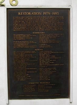
2. St. Paul's Church - Restoration 1979-1983 Marker
Directly to the left of the historical marker is a plaque commemorating the restoration of St. Paul's. The text of the plaque is presented below.
By 1979, St. Paul's had fallen into serious disrepair. Recognizing the importance of saving this historic landmark, a group of concerned citizens formed which later became the Save Saint Paul's Indian Church Society. Through their efforts extensive restoration was completed in 1883 and a fund was established for continuing preservation. A register displayed in the church records all the active society members and donors whose participation and contributions have made this project possible. This plaque gratefully acknowledges the major donors and participants.
In the interest of saving space, the plaque's list of donor's is omitted here but can be read by clicking on the above picture of the plaque.
Photographed By Andrew Ruppenstein, June 9, 2010
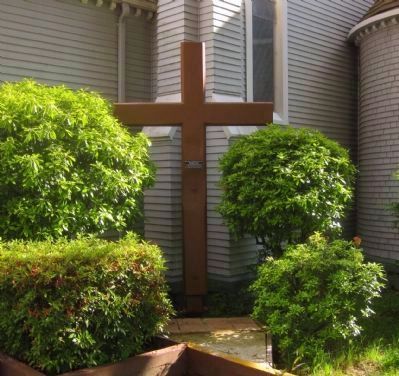
5. St. Paul's Church - the original Cross
Located on the west (or left-rear) side of the church is the church's original Cross. In 1900. this Cross was erected on the east side of the church, with Corpus. The Corpus was later removed and mounted to the Cross currently above the altar. This Cross was restored and erected on the church's west side in 2000.
Credits. This page was last revised on June 16, 2016. It was originally submitted on June 30, 2010, by Andrew Ruppenstein of Lamorinda, California. This page has been viewed 1,692 times since then and 16 times this year. Photos: 1, 2, 3, 4, 5. submitted on June 30, 2010, by Andrew Ruppenstein of Lamorinda, California. 6, 7, 8. submitted on July 1, 2010, by Andrew Ruppenstein of Lamorinda, California. • Syd Whittle was the editor who published this page.
