Near Apache Junction in Pinal County, Arizona — The American Mountains (Southwest)
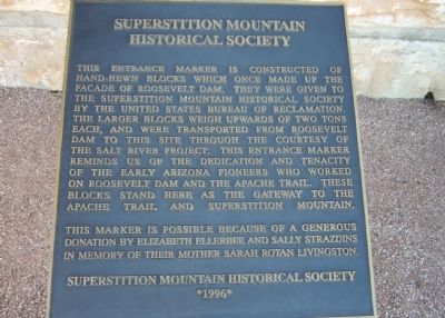
Superstition Mountain Historical Society
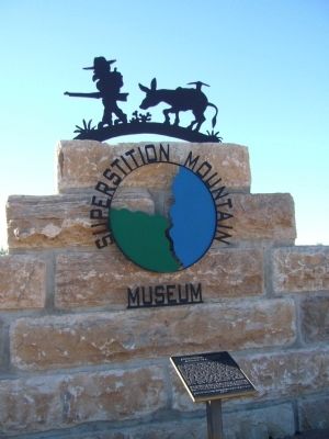
This entrance marker is constructed of hand-hewn blocks which once made up the façade of Roosevelt Dam. They were given to the Superstition Mountain Historical Society by the United States Bureau of Reclamation. The larger blocks weigh upwards of two tons each, and were transported from Roosevelt Dam to this site through the courtesy of the Salt River Project. This entrance marker reminds us of the dedication and tenacity of the early Arizona pioneers who worked on Roosevelt Dam and the Apache Trail. These blocks stand here as the gateway to the Apache Trail and Superstition Mountain.
This marker is possible because of a generous donation by Elizabeth Ellerbee and Sally Strazdins in memory of their mother Sarah Rotan Livingston.
Erected 1996 by Superstition Mountain Historical Society.
Topics. This historical marker is listed in these topic lists: Architecture • Charity & Public Work • Industry & Commerce • Waterways & Vessels.
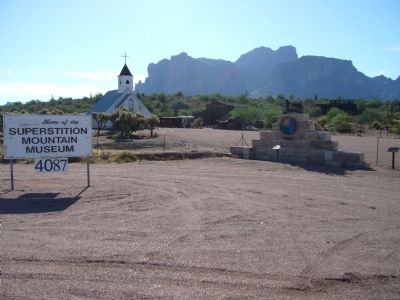
Location. 33° 26.844′ N, 111° 30.128′ W. Marker is near Apache Junction, Arizona, in Pinal County. Marker is on East Apache Trail (Arizona Route 88 at milepost 199), on the right when traveling east. Touch for map. Marker is at or near this postal address: 4087 East Apache Trail, Apache Junction AZ 85119, United States of America. Touch for directions.
Other nearby markers. At least 8 other markers are within 9 miles of this marker, measured as the crow flies. Goldfield Mining District (a few steps from this marker); Ghost Town of Goldfield (approx. 1.1 miles away); Bluebird Mine and Gift Shop (approx. 1.1 miles away); a different marker also named Goldfield Mining District (approx. 1.1 miles away); Apache Trail (approx. 3.3 miles away); Jacob Von Walzer (approx. 3½ miles away); Canyon Lake (approx. 7.2 miles away); The Dutchman’s Inn (approx. 8½ miles away). Touch for a list and map of all markers in Apache Junction.
Credits. This page was last revised on August 16, 2020. It was originally submitted on August 5, 2010, by Bill Kirchner of Tucson, Arizona. This page has been viewed 1,172 times since then and 34 times this year. Photos: 1, 2, 3. submitted on August 5, 2010, by Bill Kirchner of Tucson, Arizona. • Syd Whittle was the editor who published this page.


