Near Belington in Barbour County, West Virginia — The American South (Appalachia)
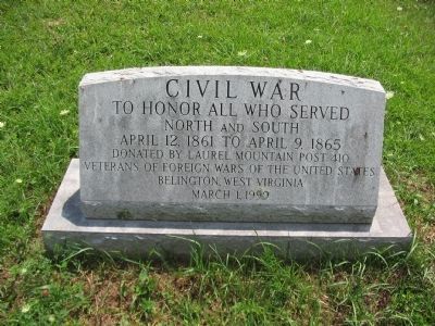
Civil War
North and South
April 12, 1861 to April 9, 1865
donated by Laurel Mountain Post 410
Veterans of Foreign Wars of the United States
Belington, West Virginia
March 1, 1999
Erected 1999 by Veterans of Foreign Wars, Laurel Mountain Post 410.
Topics. This historical marker is listed in this topic list: War, US Civil. A significant historical date for this entry is March 1, 1999.
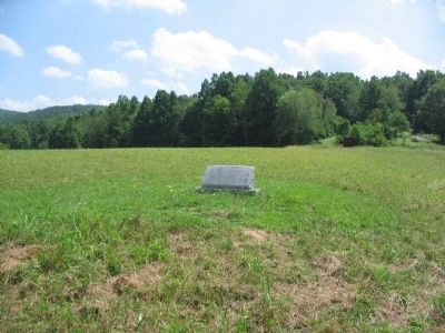
Location. 39° 0.524′ N, 79° 54.618′ W. Marker is near Belington, West Virginia, in Barbour County. Marker can be reached from Laurel Mountain Road (County Route 15), on the right when traveling east. Located in Laurel Hill Camp beside the Mill Creek Reservoir. Touch for map. Marker is in this post office area: Belington WV 26250, United States of America. Touch for directions.
Other nearby markers. At least 8 other markers are within walking distance of this marker. Welcome to Camp Laurel Hill (about 400 feet away, measured in a direct line); Laurel Hill (about 400 feet away); Laurel Hill Battlefield Veterans Memorial (about 500 feet away); In Honor of these whose Sacrifices Created this Hallowed Ground (about 600 feet away); a different marker also named Laurel Hill (about 700 feet away); Camp Laurel Hill (about 700 feet away); Battle of Laurel Hill (approx. 0.2 miles away); Forced Flight (approx. 0.2 miles away). Touch for a list and map of all markers in Belington.
Credits. This page was last revised on March 29, 2024. It was originally submitted on August 15, 2010, by Craig Swain of Leesburg, Virginia. This page has been viewed 1,020 times since then and 27 times this year. Photos: 1, 2. submitted on August 15, 2010, by Craig Swain of Leesburg, Virginia.

