Fort Belvoir in Fairfax County, Virginia — The American South (Mid-Atlantic)
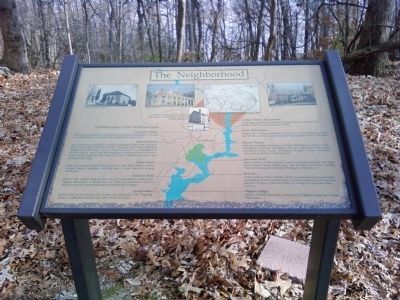
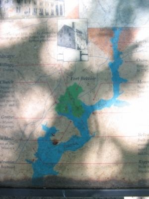
The Neighborhood
Prominent places in the colonial landscape
Accotink Village:
The town of Accotink was started as a 17th century meeting place. During the colonial period a gristmill and racetrack were located here.
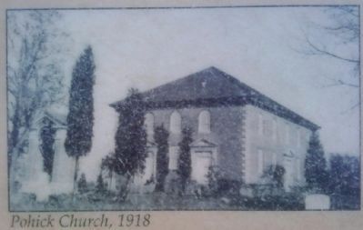
Pohick Church:
Truro Parish was established in 1732 for Virginians north of the Occoquan River. Pohick Church was builtin 1769. Members of the Virginia House of Burgesses and the King's Council comprised much of the congregation in the 18th century. The Fairfax and Washington families held the front pews in the church, indicating their important role in building the church and serving in the vestry.
Cedar Grove:
Estate of Captain Daniel McCarty and his wife, Sarah Eillback Mason, George Mason's daughter. McCarty was a close friend of George Washington.
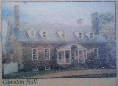
Gunston Hall:
Built in 1758, Gunston Hall was the home of George Mason, author of the Virginia Declaration of Rights and the Virginia Constitution. Mason's refusal to sign the Constitution helped create the Bill of Rights.
Leesylvania:
Home of Henry Lee II and Lucy Grymes Lee, built circa 1750. Boyhood home of "Light Horse Harry" Lee, father of Robert E. Lee.
Carlyle House, Alexandria:
In the heart of historic Alexandria, Carlyle House was built by John Carlyle, husband of Sarah Fairfax, in 1745.
Oxon Hill Manor:
Built in 1711 by Thomas Addison, 1st surveyor of Prince George's County. In 1787, Oxon Hill was leased to George Washington's cousin, Nathaniel.
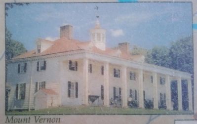
Mount Vernon:
Built by Augustine Washington, George Washington's father in 1735. Inherited by Lawrence Washington, George's elder half brother. After Lawrence's death, George Washington bought it from Lawrence's widow, Anne (Fairfax) Washington Lee.
Marshall Hall:
Built in 1690 by William Marshall, passed to Thomas Marshall, who was a close friend of George Washington. Also the site of 1745 Ferry Landing. This land became part of George Washington's Union Farm.
Belvoir:
Built in 1741 by William Fairfax, Belvoir was the plantation where initial management of the Northern Neck Proprietary took place. William was asked by Thomas, Sixth Lord Fairfax, to manage this important land holding.
Rippon Lodge:
Built by Richard Blackburn, close friend of William Fairfax and George Washington.
Topics and series. This historical marker is listed in this topic list: Colonial Era. In addition, it is included in the Former U.S. Presidents: #01 George Washington series list. A significant historical year for this entry is 1732.
Location. 38° 40.765′ N, 77° 7.778′ W. Marker is in Fort Belvoir, Virginia, in Fairfax County. Marker can be reached from Forney Loop, on the right when traveling east. Located along the Belvoir and Potomac View Trail, reached from a parking area off Forney Lane, on Fort Belvoir. Touch for map. Marker is in this post office area: Fort Belvoir VA 22060, United States of America. Touch for directions.
Other nearby markers. At least 8 other markers are within walking distance of this marker. The Influence of the Fairfax Family (here, next to this marker); Life at Belvoir (a few steps from this marker); The Fairfax Family (within shouting distance of this marker); Gardens and Kitchen at Belvoir (within shouting distance of this marker); Belvoir Grounds and Potomac View Trail (within shouting distance of this marker); Belvoir (within shouting distance of this marker); Ferdinando, and the End of the Fairfax Ownership (within shouting distance of this marker); The Army Comes to Belvoir (within shouting distance of this marker). Touch for a list and map of all markers in Fort Belvoir.
More about this marker. The marker is on Fort Belvoir, an active U.S. Army installation. Please check the links below for site access information.
Credits. This page was last revised on November 22, 2021. It was originally submitted on August 31, 2010, by Craig Swain of Leesburg, Virginia. This page has been viewed 948 times since then and 16 times this year. Photos: 1. submitted on December 16, 2010, by Lee Hattabaugh of Capshaw, Alabama. 2. submitted on August 31, 2010, by Craig Swain of Leesburg, Virginia. 3. submitted on August 30, 2010, by Craig Swain of Leesburg, Virginia. 4, 5, 6. submitted on December 16, 2010, by Lee Hattabaugh of Capshaw, Alabama.
