Brookfield in Fairfield County, Connecticut — The American Northeast (New England)
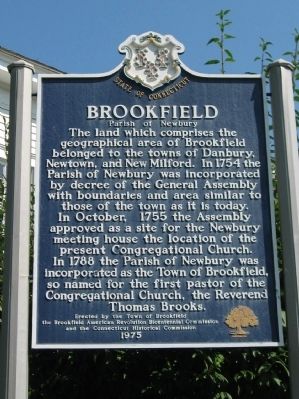
Brookfield
Parish of Newbury
Erected by the Town of Brookfield
the Brookfield American Revolution Bicentennial Commission
and the Connecticut Historical Commission
1975
Erected 1975 by the Town of Brookfield, the Brookfield American Revolution Bicentennial Commission,the Connecticut Historical Commission.
Topics. This historical marker is listed in these topic lists: Colonial Era • Settlements & Settlers. A significant historical month for this entry is October 1755.
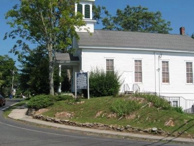
Location. 41° 27.965′ N, 73° 23.264′ W. Marker is in Brookfield, Connecticut, in Fairfield County. Marker is at the intersection of Whisconier Road (Connecticut Route 25) and Obtuse Hill Road ( Connecticut Route 133), on the right when traveling north on Whisconier Road. Located in front of the Brookfield Historical Society building. Touch for map. Marker is at or near this postal address: 165 Whisconier Road, Brookfield CT 06804, United States of America. Touch for directions.
Other nearby markers. At least 8 other markers are within 5 miles of this marker, measured as the crow flies. First Settlement 1710 (a few steps from this marker); Brookfield Veterans Monument (approx. 0.3 miles away); Space Shuttle Tire (approx. 4.6 miles away); Childhood Home of Capt. William D. Burnham (approx. 4.8 miles away); Bridgewater (approx. 4.8 miles away); Twin Red Oaks (approx. 4.8 miles away); Bridgewater Center (approx. 4.9 miles away); Bridgewater WW I Memorial (approx. 4.9 miles away). Touch for a list and map of all markers in Brookfield.
Also see . . .
1. Brookfield, Connecticut. Wikipedia entry (Submitted on September 1, 2010, by Michael Herrick of Southbury, Connecticut.)
2. History of Brookfield. Brookfield Historical Society website entry (Submitted on September 1, 2010, by Michael Herrick of Southbury, Connecticut.)
Credits. This page was last revised on April 22, 2022. It was originally submitted on September 1, 2010, by Michael Herrick of Southbury, Connecticut. This page has been viewed 971 times since then and 23 times this year. Photos: 1, 2, 3. submitted on September 1, 2010, by Michael Herrick of Southbury, Connecticut.


