Brandywine in Prince George's County, Maryland — The American Northeast (Mid-Atlantic)
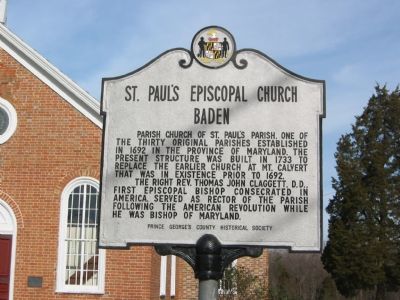
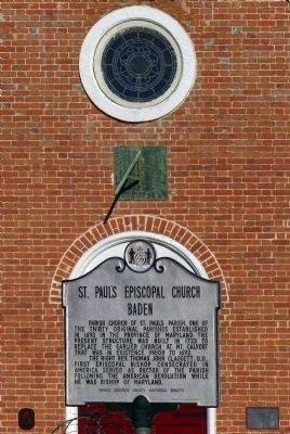
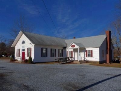
St. Paul's Episcopal Church
Baden
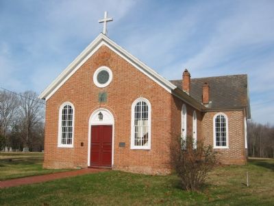
Parish Church of St. Paul's Parish, one of the thirty original parishes established in 1692 in the Province of Maryland. The present structure was built in 1733 to replace the earlier church at Mt. Calvert that was in existence prior to 1692.
The Right Rev. Thomas John Claggett, D.D., first Episcopal Bishop consecrated in America, served as rector of the parish following the American Revolution while he was Bishop of Maryland.
Erected by Prince George's County Historical Society.
Topics. This historical marker is listed in these topic lists: Churches & Religion • Colonial Era. A significant historical year for this entry is 1692.
Location. 38° 39.631′ N, 76° 46.296′ W. Marker is in Brandywine, Maryland, in Prince George's County. Marker is at the intersection of Baden Westwood Road and Horsehead Road, on the right when traveling west on Baden Westwood Road. Touch for map. Marker is at or near this postal address: 13601 Baden Westwood Road, Brandywine MD 20613, United States of America. Touch for directions.
Other nearby markers. At least 8 other markers are within 5 miles of this marker, measured as the crow flies. Immanuel Church (approx. 0.6 miles away); Up in Flames (approx. 4.4 miles away); Home of Dr. Samuel Mudd (approx. 4˝ miles away); Dr. Samuel A. Mudd (approx. 4˝ miles away); John Wilkes Booth (approx. 4˝ miles away); Dr. Samuel A. Mudd House (approx. 4.6 miles away); Town Ravaged (approx. 4.8 miles away); Lower Marlboro Town (approx. 4.9 miles away).
Also see . . . St. Paul's Episcopal Church. (PDF)National Register Nomination Form (MDIHP) (Submitted on December 28, 2014, by Allen C. Browne of Silver Spring, Maryland.)
Credits. This page was last revised on August 17, 2019. It was originally submitted on November 16, 2007, by F. Robby of Baltimore, Maryland. This page has been viewed 2,053 times since then and 30 times this year. Photos: 1. submitted on November 16, 2007, by F. Robby of Baltimore, Maryland. 2, 3. submitted on December 28, 2014, by Allen C. Browne of Silver Spring, Maryland. 4. submitted on November 16, 2007, by F. Robby of Baltimore, Maryland. 5, 6, 7. submitted on December 28, 2014, by Allen C. Browne of Silver Spring, Maryland.
