Near Spotsylvania Courthouse in Spotsylvania County, Virginia — The American South (Mid-Atlantic)
Jackson on the Move
The Battle of Chancellorsville
— Fredericksburg and Spotsylvania National Military Park —
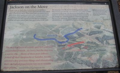
About 10 a.m. on May 2, 1863, Confederate General Thomas J. "Stonewall" Jackson's flanking column approached this then-cleared ridge on the Furnace Road. Union infantrymen perched in trees at Hazel Grove, three-quarters of a mile to the northwest, spotted the Confederates. Federal artillery opened fire, compelling Jackson's troops to hurry past this exposed spot. The general ordered his artillery and wagon trains to take a safer road, further south.
The harassing Union fire did little to disrupt Jackson's column. Had you been here that day, you would have seen a much narrower road packed with troops four abreast moving steadily at a slow tramp. For six hours a continuous stream of soldiers moved by. The passage here alerted the Federals to Jackson's movement but not to his destination. They would soon respond in more substantial form - at Catharine Furnace, a half-mile to the west.
The men had been in winter quarters and had accumulated much...to carry, but the day was a warm one.... Many of these poor fellows...jerked off their knapsacks or bundles, hastily selected a few precious things and abandoning their cherished possessions ran on to resume their places.
Lieutenant Frederick Colston, Confederate staff officer.
By this point, Jackson's men had covered only two of the twelve miles they would march that day. When the head of the column reached here, the rear of the column had not yet started to march.
Erected by National Park Service, U.S. Department of the Interior.
Topics. This historical marker is listed in this topic list: War, US Civil. A significant historical month for this entry is May 1844.
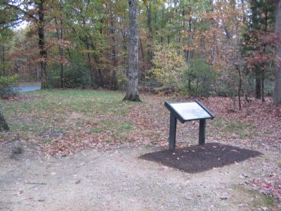
Location. 38° 17.322′ N, 77° 38.231′ W. Marker is near Spotsylvania Courthouse, Virginia, in Spotsylvania County. Marker is on McLaws Drive, on the right when traveling south. Located at the Maury's Birthplace stop, an un-numbered stop on the Battle of Chancellorsville driving tour. Touch for map. Marker is at or near this postal address: 12015 Sawhill Blvd, Spotsylvania VA 22553, United States of America. Touch for directions.
Other nearby markers. At least 8 other markers are within walking distance of this marker. Matthew Fontaine Maury (here, next to this marker); Maury House Trail (a few steps from this marker); Birthplace of Matthew Fontaine Maury (1806-1873) (about 500 feet away, measured in a direct line); Maury Birthplace (about 500 feet away); About a mile in the distance... (about 700 feet away); Chancellorsville Campaign (approx. 0.4 miles away); A Region of Gloom (approx. 0.6 miles away); Catharine Furnace (approx. 0.6 miles away). Touch for a list and map of all markers in Spotsylvania Courthouse.
More about this marker. The background of the marker is a map illustration with the route of Jackson's march in red, with the Federal lines indicated in blue. The location of the marker is also indicated.
Regarding Jackson on the Move. This is one of several markers for the Battle of Chancellorsville along McLaws Drive, Furnace Road, Sickles Drive, and East Jackson Trail, on the east side of the battlefield. See the McLaws's Line to Catharine Furnace Virtual Tour by Markers in the links section for a listing of related markers on the tour.
Also see . . . McLaws's Line to Catharine Furnace Virtual Tour by Markers. Spread across a two mile segment on the east side of the battlefield, this virtual tour by markers covers action from May 1-3, 1863. (Submitted on November 16, 2007, by Craig Swain of Leesburg, Virginia.)
Credits. This page was last revised on April 25, 2023. It was originally submitted on November 16, 2007, by Craig Swain of Leesburg, Virginia. This page has been viewed 1,182 times since then and 12 times this year. Photos: 1, 2, 3. submitted on November 16, 2007, by Craig Swain of Leesburg, Virginia.


