Columbus in Hickman County, Kentucky — The American South (East South Central)
Polk's Firepower
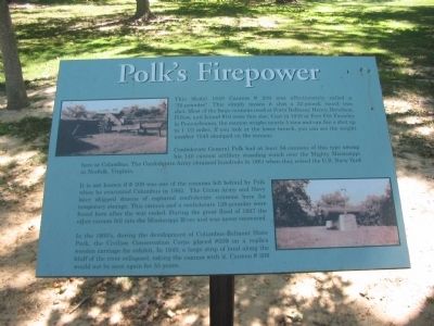
Confederate General Polk had at least 56 cannons of this type among his 140 cannon artillery standing watch over the Mighty Mississippi here at Columbus. The Confederate Army obtained hundreds in 1861 when they seized the U.S. Navy Yard in Norfolk, Virginia.
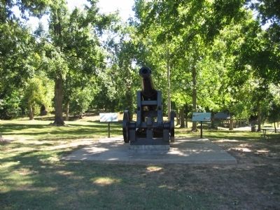
It is not known if # 209 was one of the cannons left behind by Polk when he evacuated Columbus in 1862. The Union Army and Navy later shipped dozens of captured confederate cannons here for temporary storage. This cannon and a confederate 128-pounder were found here after the war ended. During the great flood of 1927 the other cannon fell into the Mississippi River and was never recovered.
In the 1930s, during the development of Columbus-Belmont State Park, the Civilian Conservation Corps placed #209 on a replica wooden carriage for exhibit. In 1943, a large strip of land along the bluff of the river collapsed, taking the cannon with it. Cannon # 209 would not be seen again for 55 years.
Topics and series. This historical marker is listed in this topic list: War, US Civil. In addition, it is included in the Civilian Conservation Corps (CCC) series list. A significant historical year for this entry is 1829.
Location. 36° 46.001′ N, 89° 6.678′ W. Marker is in Columbus, Kentucky, in Hickman County. Located in Columbus-Belmont State Park. Touch for map. Marker is in this post office area: Columbus KY 42032, United States of America. Touch for directions.
Other nearby markers. At least 8 other markers are within walking distance of this marker. In Search Of .... (a few steps from this marker); Anchor and Chain (within shouting distance of this marker); Confederate Trenches (within shouting distance of this marker); The Mississippi River in the Civil War (within shouting distance of this marker); "Gibraltar of the West" (about 400 feet away, measured in a direct line); The History of Columbus, Kentucky (about 400 feet away); The Battle at Belmont, Missouri (about 400 feet away); Fourth United States Colored Heavy Artillery (about 700 feet away). Touch for a list and map of all markers in Columbus.
Additional commentary.
1. Some History of the Finding of the Model 1829 Cannon.
A retired schoolteacher, Eddie Roberts, took 14 years and two tries to unearth the Model 1829, 7,545-pound cannon. Starting in 1984, he eventually found it under 42 feet of dirt. In 1991 he was unsuccessful, but finally found it in 1998 thanks to the use of excavating equipment. The cannon had toppled off the Mississippi River Bluff in a 1943 landslide.
The smoothbore cannon, designed for shipboard use, was cast in 1839 by Joseph McClurg, William Wade and Company at Pittsburgh's Pennsylvania Penn Foundry, also known as Fort Pitt Foundry. McC. W. & Co, P.P.F. is stamped on the left trunnion.
— Submitted June 4, 2019, by Mark Hilton of Montgomery, Alabama.
Credits. This page was last revised on July 21, 2019. It was originally submitted on October 27, 2010, by Craig Swain of Leesburg, Virginia. This page has been viewed 970 times since then and 24 times this year. Photos: 1, 2, 3. submitted on October 27, 2010, by Craig Swain of Leesburg, Virginia.


