Springfield in Fairfax County, Virginia — The American South (Mid-Atlantic)
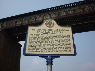
The Orange And Alexandria Railroad Trestle
Erected 2003 by Fairfax County History Commission.
Topics and series. This historical marker is listed in these topic lists: Bridges & Viaducts • Railroads & Streetcars • War, US Civil. In addition, it is included in the Orange and Alexandria Railroad, and the Virginia, Fairfax County History Commission series lists. A significant historical date for this entry is December 28, 1862.
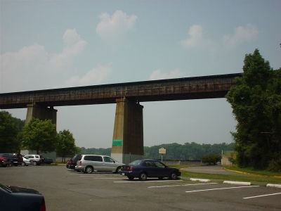
Location. Marker has been reported missing. It was located near 38° 47.553′ N, 77° 13.067′ W. Marker was in Springfield, Virginia, in Fairfax County. Marker was on Accotink Park Road , on the left when traveling east. It is in Accotink Park in the main parking lot that sits in front of the Accotink Lake dam and the current railroad bridge. Touch for map. Marker was in this post office area: Springfield VA 22151, United States of America. Touch for directions.
Other nearby markers. At least 8 other markers are within 3 miles of this location, measured as the crow flies. Orange and Alexandria Railroad (a few steps from this marker); Connecting Communities and Parks (within shouting distance of this marker); The Civilian Conservation Corps (approx. 0.4 miles away); a different marker also named Orange and Alexandria Railroad (approx. 0.6 miles away); Ravensworth (approx. 1.2 miles away); a different marker also named Ravensworth (approx. 1.2 miles away); Springfield Station (approx. 1.8 miles away); Keene’s Mill (approx. 2.1 miles away). Touch for a list and map of all markers in Springfield.
Regarding The Orange And Alexandria Railroad Trestle. The current railroad bridge is on a different alignment from the old trestle.
Credits. This page was last revised on March 18, 2023. It was originally submitted on December 18, 2005, by J. J. Prats of Powell, Ohio. This page has been viewed 4,360 times since then and 61 times this year. Photos: 1, 2. submitted on December 18, 2005, by J. J. Prats of Powell, Ohio.

