Near Wallace in Marlboro County, South Carolina — The American South (South Atlantic)
Pegues Place / Revolutionary Cartel
Pegues Place
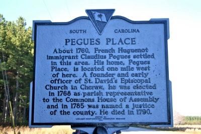
About 1760, French Huguenot immigrant Claudius Pegues settled in this area. His home, Pegues Place, is located one mile west of here. A founder and early officer of St. David's Episcopal Church in Cheraw, he was elected in 1768 as parish representative to the Commons House of Assembly and in 1785 was named a justice of the county. He died in 1790.
Revolutionary Cartel
On May 3, 1781, a cartel for the exchange of prisoners of war taken during the American Revolution was signed one mile west of here at the home of Claudius Pegues. Lt. Col. Edward Carrington acted for Maj. Gen. Nathanael Greene of the Continental Army. Capt. Frederick Cornwallis, acting for his cousin, Lieut. Gen. Earl Cornwallis, signed for the British.
Erected 1973 by Marlboro County Historic Preservation Commission. (Marker Number 35-15.)
Topics. This historical marker is listed in these topic lists: Churches & Religion • Colonial Era • Settlements & Settlers • War, US Revolutionary. A significant historical month for this entry is May 1788.
Location. 34° 48′ N, 79° 53.357′ W. Marker is near Wallace, South Carolina, in Marlboro County. Marker is at the intersection of U.S. 1 and Pegues Drive, on the left when traveling north on U.S. 1. Marker is near the North/South Carolina line. Touch for map. Marker is in this post office area: Wallace SC 29596, United States of America. Touch for directions.
Other nearby markers. At least 8 other markers are within 7 miles of this marker, measured as the crow flies. North Carolina / South Carolina (approx. half a mile away in North Carolina); Sherman's March (approx. 0.6 miles away in North Carolina); a different marker also named North Carolina / South Carolina (approx. 4.6 miles away in North Carolina); Henry William Harrington (approx. 5.3 miles away in North Carolina); Albert M. Shipp (approx. 5.6 miles away); Greene's Encampment / Sherman's March (approx. 5.7 miles away); John Lyde Wilson (approx. 6.4 miles away); John J. McRae (approx. 6.7 miles away in North Carolina). Touch for a list and map of all markers in Wallace.
Also see . . . Pegues Place National Register of Historic Places Nomination Form. (Submitted on November 21, 2010, by PaulwC3 of Northern, Virginia.)
Credits. This page was last revised on December 14, 2019. It was originally submitted on November 16, 2010, by David Bullard of Seneca, South Carolina. This page has been viewed 2,101 times since then and 112 times this year. Photos: 1, 2. submitted on November 16, 2010, by David Bullard of Seneca, South Carolina. • Bill Pfingsten was the editor who published this page.
Editor’s want-list for this marker. A wide shot of the marker and its surroundings. • Can you help?

