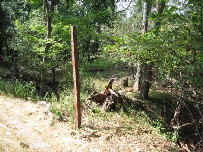
Near Sandy Hook in Washington County, Maryland — The American Northeast (Mid-Atlantic)
100 - Pounder Battery - Heaviest and Highest
Inscription.
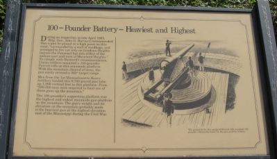
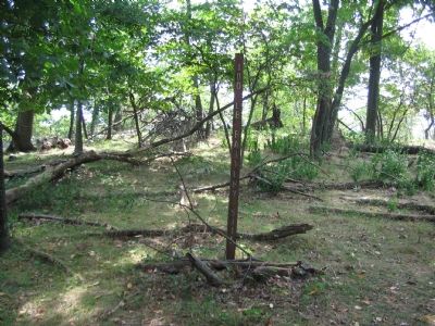
During an inspection in late April 1863, Brig. Gen. John G. Barnard recommended that a gun be placed at a high point on this crest, "surrounded by a wall of sandbags, and arranged to fire not only on Loudoun Heights [across the Potomac] but into either of the valleys east and west of Maryland Heights." To comply with Barnard's recommendation, Union soldiers mounted a 100-pounder Parrott rifle on this manmade platform. With the mountain cleared of trees, the gun easily covered a 360° target range.
Men from the 1st Massachusetts Heavy Artillery hauled this 9,700-pound gun tube up 1,200 vertical feet to this platform. From "200-500 men were required to haul one of these guns up the mountain."
The 100-pounder's supporting platform was the highest and widest manmade gun platform on the mountain. The gun's weight and elevation on the mountain probably made it the heaviest gun at the highest elevation east of the Mississippi during the Civil War.
Topics. This historical marker is listed in this topic list: War, US Civil. A significant historical month for this entry is April 1863.
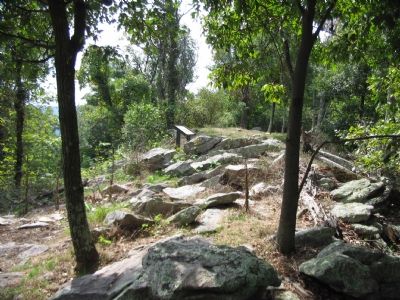
Location. 39° 20.117′ N, 77° 43.15′ W. Marker is near Sandy Hook, Maryland, in Washington County. Marker can be reached from Sandy Hook Road, on the right when traveling west. Located on the Stone Fort Trail loop of Maryland Heights in Harpers Ferry National Historical Park. Touch for map. Marker is in this post office area: Knoxville MD 21758, United States of America. Touch for directions.
Other nearby markers. At least 8 other markers are within walking distance of this marker. Civil War Campgrounds (approx. ¼ mile away); Charcoal Making on Maryland Heights (approx. ¼ mile away); Making a Mountain Citadel (approx. 0.3 miles away); 30-Pounder Battery (approx. 0.4 miles away); Exterior Fort (approx. 0.4 miles away); Interior Fort (approx. half a mile away); Hiking Maryland Heights (approx. half a mile away); Stone Fort (approx. half a mile away). Touch for a list and map of all markers in Sandy Hook.
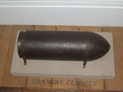
More about this marker. On the right side of the marker is a sketch of the gun, mounted on its pintle carriage, when fully emplaced. "The projectile for this model of Parrott rifle weighed 100 pounds - hence the name for the gun and the battery."
Regarding 100 - Pounder Battery - Heaviest and Highest. This marker is one of a set along the National Park Service's trail to the top of Maryland Heights.

Photographed By Craig Swain, September 22, 2007
5. East Field of View from the Battery
The Potomac threads it way through the mountains in the center. On the right side is Short Hill Mountain. The bridge over the Potomac in the far distance is at Brunswick, Maryland, nearly five miles away, where a pontoon bridge crossed the Potomac in 1863. The trees around the platform were cleared when the battery was active, giving a similar field of view to other sides of the heights.
The gun fired a 6.4 inch diameter projectile to ranges approaching five miles. So the Parrott gun here could have theoretically ranged forces crossing at that point. Interestingly the gun's range falls just short of Boteler's Ford to the west and upstream on the Potomac, where the Confederates crossed into Maryland on several occasions.
The gun fired a 6.4 inch diameter projectile to ranges approaching five miles. So the Parrott gun here could have theoretically ranged forces crossing at that point. Interestingly the gun's range falls just short of Boteler's Ford to the west and upstream on the Potomac, where the Confederates crossed into Maryland on several occasions.
Credits. This page was last revised on March 19, 2022. It was originally submitted on November 29, 2007, by Craig Swain of Leesburg, Virginia. This page has been viewed 2,308 times since then and 129 times this year. Photos: 1, 2, 3, 4, 5. submitted on November 29, 2007, by Craig Swain of Leesburg, Virginia. 6. submitted on January 27, 2008, by Craig Swain of Leesburg, Virginia.
