Near Kingston, Ontario — Central Canada (North America)
Fort Henry
In English:
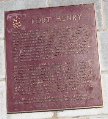
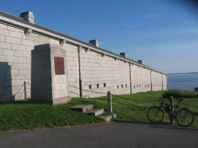
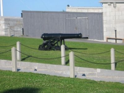
An earlier fort was built here on Point Henry during the War of 1812 primarily to defend the nearby naval dockyard. When the Rideau Canal was built as part of a military route connecting Kingston with Montreal, the strategic importance of this site increased. The old fort was therefore replaced by the present structure of stronger and more advanced design which was completed in 1836 at a cost of over £70,000. Garrisoned by units of the British and then the Canadian Army until 1890, the fort never saw action, although it was used as a prison for rebels captured during the Rebellions of 1837-38.
In French:
Durant la guerre de 1812, un premier fort fut construit ici, sur la point Henry, principalement pour defendre le chantier naval voisin. Quand le canal Rideau fut construit pour relier militairement Kingston a Montreal, l'importance strategique du lieu augmenta. Le vieux fort fit place a l'ouvrage actuel plus moderne, qui fut complete en 1836, au cout de L70,000. Servant de garnison aux unites anglaises et a celles de larmee canadienne jusqu'en 1890, le fort ne fut jamais attaque, mais il a servi de prison aux rebelles des insurrections de 1837-1838.
Historic Sites and Monuments Board of Canada
Commission des lieux et monuments historiques du Canada.
Government of Canada - Gouvernement du Canada
Erected by Historic Sites and Monuments Board of Canada.
Topics and series. This historical marker is listed in this topic list: Military. In addition, it is included in the Canada, Historic Sites and Monuments Board series list. A significant historical year for this entry is 1812.
Location. 44° 13.831′ N, 76° 27.641′ W. Marker is near Kingston, Ontario. Marker can be reached from Provincial Highway 2. Touch for map. Marker is in this post office area: Kingston ON K7K 5G8, Canada. Touch for directions.
Other nearby markers. At least 8 other markers are within walking distance of this marker. A different marker also named Fort Henry (within shouting distance of this marker); Kingston Navy Yard (approx. half a kilometer away); The Stone Frigate (approx. half a kilometer away); Strategic Importance / Importance Stratégique (approx. half a kilometer away); Point Frederick Buildings (approx. 0.7 kilometers away); Sir James Lucas Yeo (approx. 0.7 kilometers away); Commodore’s Residence, 1815 (approx. 0.7 kilometers away); Point Frederick (approx. 0.8 kilometers away). Touch for a list and map of all markers in Kingston.
More about this marker. Kingston is independent from the surrounding Frontenac County.
Regarding Fort Henry. The present Fort Henry was constructed between 1832
and 1837. It was constructed to protect the Lake Ontario end of the Rideau Canal. A system of defensive works was planned but cost overruns in the construction of canal limited the fortifications to four Martello towers and the fort.
Also see . . . Fort Henry. Kingston Attractions Website entry (Submitted on March 22, 2021, by Larry Gertner of New York, New York.)
Credits. This page was last revised on March 27, 2024. It was originally submitted on December 31, 2010, by Bob (peach) Weber of Dewey, Arizona. This page has been viewed 900 times since then and 16 times this year. Photos: 1, 2, 3, 4, 5, 6. submitted on December 31, 2010, by Bob (peach) Weber of Dewey, Arizona. • Syd Whittle was the editor who published this page.
