Tomah in Monroe County, Wisconsin — The American Midwest (Great Lakes)
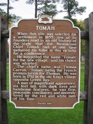
Tomah
He suggested the name "Tomah" for the new village, and his choice was adopted.
The chief's name was Thomas Carron, "Tomah" being the French pronunciation for Thomas. He was born in 1752 in the old King's village opposite Green Bay.
A man of magnificent appearance, six feet tall, with dark eyes and handsome features, he was firm, peaceable, conciliatory, and sincerely loved by the red and white men of his time.
Erected 1959 by the Wisconsin Historical Society. (Marker Number 88.)
Topics and series. This historical marker is listed in these topic lists: Native Americans • Settlements & Settlers. In addition, it is included in the Wisconsin Historical Society series list. A significant historical year for this entry is 1855.
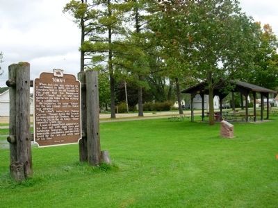
Location. 43° 59.549′ N, 90° 30.26′ W. Marker is in Tomah, Wisconsin, in Monroe County. Marker is on North Superior Avenue (U.S. 12) north of Arthur Street, on the right when traveling north. Marker is in Butts Park. Touch for map. Marker is in this post office area: Tomah WI 54660, United States of America. Touch for directions.
Other nearby markers. At least 6 other markers are within 16 miles of this marker, measured as the crow flies. Robert Howie (approx. 2.2 miles away); In Honor of All Who Have Served (approx. 8.1 miles away); Ice Age National Scientific Reserve (approx. 9.9 miles away); Mesas and Buttes (approx. 10 miles away); Back Breaking Work (approx. 12.3 miles away); Elroy – Sparta State Trail (approx. 15.3 miles away).
Also see . . . Tomah, Wisconsin History. Tomah Chamber of Commerce website. Boyhood home of Frank King, creator of Gasoline Alley. (Submitted on December 4, 2007.)
Credits. This page was last revised on June 16, 2016. It was originally submitted on December 4, 2007, by Keith L of Wisconsin Rapids, Wisconsin. This page has been viewed 1,993 times since then and 65 times this year. Photos: 1. submitted on December 4, 2007, by Keith L of Wisconsin Rapids, Wisconsin. 2. submitted on October 7, 2010, by Paul Fehrenbach of Germantown, Wisconsin. • J. J. Prats was the editor who published this page.

