San Domingo in Wicomico County, Maryland — The American Northeast (Mid-Atlantic)
San Domingo School
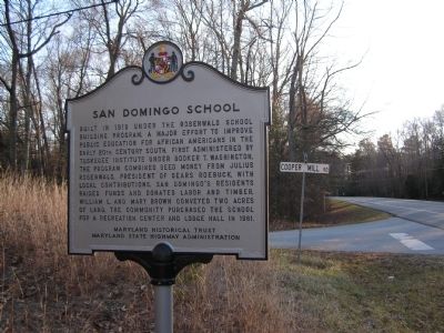
Photographed by Nate Davidson, January 21, 2011
1. San Domingo School Marker
Erected 2009 by Maryland Historical Trust & Maryland State Highway Administration.
Topics and series. This historical marker is listed in these topic lists: African Americans • Charity & Public Work • Education. In addition, it is included in the Maryland Historical Trust, and the Rosenwald Schools series lists. A significant historical year for this entry is 1919.
Location. 38° 30.783′ N, 75° 44.65′ W. Marker is in San Domingo, Maryland, in Wicomico County. It is on Sharptown/Mardela Springs Road (Maryland Route 313). Touch for map. Marker is in this post office area: Mardela
this page online

Regionally, this marker is on the Eastern Shore. It is also in the American Mid-Atlantic, on the Delmarva Peninsula, in the Tidewater, and on the Eastern Seaboard. Globally, it is in the North Atlantic Region, North America, the Western Hemisphere, the Western World, and the Anglosphere. Historically, it finds itself in what was once one of the original Thirteen Colonies and also the Antebellum South.
Other nearby markers. At least 8 other markers are within 4 miles of this marker, measured as the crow flies: San Domingo School Community & Cultural Center (approx. 1.2 miles away); Sharptown War Memorial (approx. 2.3 miles away); Veterans Memorial (approx. 2.4 miles away); Chesapeake Bay Restoration in Progress (approx. 2.6 miles away); Gravenor-English School (approx. 3.6 miles away); Young's Purchase Farmhouse (approx. 3.6 miles away); Young's Purchase Home (approx. 3.6 miles away); The Doctor's Office (approx. 3.6 miles away).
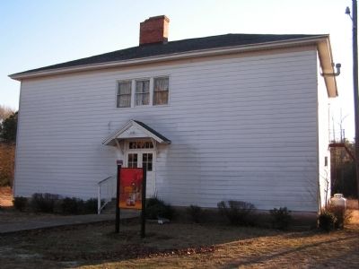
Photographed by Nate Davidson, January 21, 2011
2. San Domingo School
Credits. This page was last revised on January 1, 2025. It was originally submitted on January 22, 2011, by Nathan Davidson of Salisbury, Maryland. This page has been viewed 1,842 times since then and 86 times this year. Photos: 1, 2. submitted on January 22, 2011, by Nathan Davidson of Salisbury, Maryland. • Bill Pfingsten was the editor who published this page.
