Munfordville in Hart County, Kentucky — The American South (East South Central)
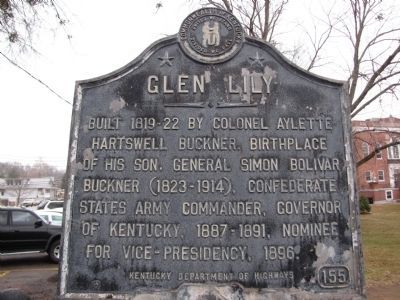
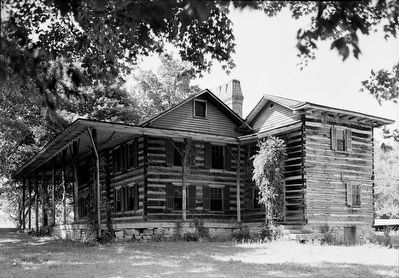
Glen Lily
Erected by Kentucky Department of Highways. (Marker Number 155.)
Topics and series. This historical marker is listed in these topic lists: Government & Politics • Settlements & Settlers • War, US Civil. In addition, it is included in the Kentucky Historical Society series list. A significant historical year for this entry is 1896.
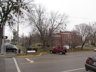
Location. Marker has been reported missing. It was located near 37° 16.31′ N, 85° 53.445′ W. Marker was in Munfordville, Kentucky, in Hart County. Marker was at the intersection of Dixie Highway / Main Street (U.S. 31W) and Union Street (State Highway 357), on the left when traveling south on Dixie Highway / Main Street. Located at the southwest corner of the Hart County Courthouse grounds. Touch for map. Marker was in this post office area: Munfordville KY 42765, United States of America. Touch for directions.
Other nearby markers. At least 8 other markers are within walking distance of this location. Henry Clay Furnace / Iron Made in Kentucky (here, next to this marker); William Boone's Grave (within shouting distance of this marker); Hart County, 1819 (within shouting distance of this marker); Church-Hospital (within shouting distance of this marker); William Clark and Family (within shouting distance of this marker); a different marker also named Hart County (within shouting distance of this marker); Hart County War Memorial (within shouting distance of this marker); Remembering the Sacrifices of War (within shouting distance of this marker). Touch for a list and map of all markers in Munfordville.
Credits. This page was last revised on June 28, 2021. It was originally submitted on January 28, 2011, by Lee Hattabaugh of Capshaw, Alabama. This page has been viewed 2,119 times since then and 82 times this year. Photos: 1, 2. submitted on January 28, 2011, by Lee Hattabaugh of Capshaw, Alabama. 3. submitted on September 9, 2015. • Craig Swain was the editor who published this page.


