Libertytown in Frederick County, Maryland — The American Northeast (Mid-Atlantic)
Libertytown
Hot, Humid, and Worn Out
— Gettysburg Campaign —
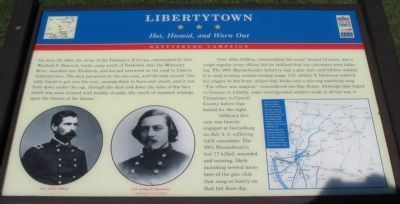
On June 29, 1863, the Army of the Potomac's II Corps, commanded by Gen. Winfield S. Hancock, broke camp south of Frederick near the Monocacy River, marched into Frederick, and turned eastward on the road to Liberty (Libertytown). The men perspired as the sun rose, and the heat caused "the salty liquid to get into the eyes, causing them to burn and smart, and it ran from down under the cap, through the dust and down the sides of the face which was soon covered with muddy streaks, the result of repeated wipings upon the sleeves of the blouse."
Gen. John Gibbon, commanding the corps' Second Division, was a tough regular army officer, but he realized that his volunteers were faltering. The 19th Massachusetts Infantry had a glee club, and Gibbon wanted it to sing rousing, morale-raising songs. Col. Arthur F. Devereux ordered his his singers to the front, where they broke into a stirring marching son. "The effect was magical," remembered one Bay Stater. Although they hoped to bivouac in Liberty, some reinvigorated soldiers made it all the way to Uniontown in Carroll County before they halted for the night.
Gibbon's division was heavily engaged at Gettysburg on July 2-3, suffering 1,651 casualties. The 19th Massachusetts lost 77 killed, wounded, and missing, likely including several members of the glee club that sang so lustily on that hot June day.
Erected by Maryland Civil War Trails.
Topics and series. This historical marker is listed in this topic list: War, US Civil. In addition, it is included in the Maryland Civil War Trails series list. A significant historical month for this entry is June 1862.
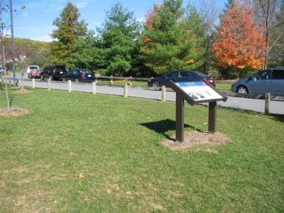
Location. This marker has been replaced by another marker nearby. It was located near 39° 29.054′ N, 77° 14.174′ W. Marker was in Libertytown, Maryland, in Frederick County. Marker was on Liberty Road / Main Street (Maryland Route 26), on the right when traveling west. Located along the entrance to Libertytown Community Park. Touch for map. Marker was in this post office area: Libertytown MD 21762, United States of America. Touch for directions.
Other nearby markers. At least 8 other markers are within 6 miles of this location, measured as the crow flies. A different marker also named Libertytown (within shouting distance of this marker); The Union Advance to Gettysburg (approx. 5.1 miles away); Stuart's Horse Raid of 1862 (approx. 5.1 miles away); Israel's Creek (approx. 5.2 miles away); George Poe (approx. 5.2 miles away); Col. Joseph Wood (approx. 5.6 miles away); Site of the Slagle Inn (approx. 5.6 miles away); In Remembrance (approx. 6.1 miles away).
More about this marker. On the lower left are
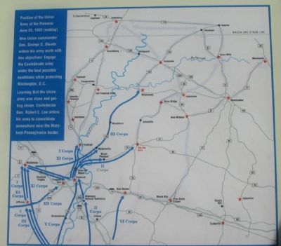
portraits of Gen. Gibbon and Col. Devereux. On the right is a campaign map showing the routes taken by the Union armies pursuing to Gettysburg is on the lower right, captioned, "Position of the Union Army of the Potomac June 29, 1863 (midday). New Union commander Gen. George G. Meade orders his army north with two objectives: Engage the Confederate army under the best possible conditions while protecting Washington, D.C. Learning that the Union army was close and getting closer, Confederate Gen. Robert E. Lee orders his army to consolidate somewhere near the Maryland-Pennsylvania border."
Related marker. Click here for another marker that is related to this marker. New CWT Marker At This Location also titled "Libertytown".
Also see . . . 19th Massachusetts Infantry Regiment. Wikipedia entry (Submitted on September 18, 2022, by Larry Gertner of New York, New York.)
Credits. This page was last revised on March 6, 2024. It was originally submitted on December 6, 2007, by Craig Swain of Leesburg, Virginia. This page has been viewed 1,943 times since then and 90 times this year. Photos: 1, 2, 3. submitted on December 6, 2007, by Craig Swain of Leesburg, Virginia.


