Jamestown in James City County, Virginia — The American South (Mid-Atlantic)
Godspeed
Specifications:
Length Overall: 88’
Beam: 17’
Draft: 7’
Mast Height: 71’ 6”
Sail Area: 2,420 square feet
Year Built: 2004 - 2006
40 tons burden
Bartholomew Gosnold, Captain
39 passengers and 13 crew, est.
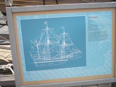
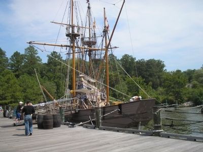
Godspeed was the second largest vessel in the fleet. It was a typical small merchant trader, but the age or origin of the original is not known. The voyage to Virginia lasted 144 days, including delays, island stops en route, and time exploring in Virginia before settling at Jamestown on May 14, 1607. John Smith recorded that Godspeed was a 40-ton vessel, and early 17th-century treatises on naval architecture and rigging served as guides for design and construction of this replica.
Topics. This historical marker is listed in this topic list: Colonial Era. A significant historical month for this entry is May 2007.
Location. 37° 13.312′ N, 76° 47.275′ W. Marker is in Jamestown, Virginia, in James City County. Marker can be reached from Jamestown Road (Virginia Route 31), on the left when traveling south. The left of the marker contains a diagram of the Godspeed labeling its various parts, including the Main Topsail, Fore Topsail, Mizzen, Main Course, Spritsail, Aft Cabin, Cargo Hold and Forecastle. Touch for map. Marker is in this post office area: Jamestown VA 23081, United States of America. Touch for directions.
Other nearby markers. At least 8 other markers are within walking distance of this marker. Voyage to Virginia (a few steps from this marker); Susan Constant (within shouting distance of this marker); Discovery (within shouting distance of this marker); Ships (within shouting distance of this marker); James Fort (about 400 feet away, measured in a direct line); Powhatan Indian Village (approx. 0.2 miles away); At Jamestown Began: (approx. 0.2 miles away); John Smith Explores the Chesapeake (approx. ¼ mile away). Touch for a list and map of all markers in Jamestown.
More about this marker. Marker is on the waterfront at the Jamestown Settlement.
Credits. This page was last revised on June 16, 2016. It was originally submitted on February 13, 2011, by Bill Coughlin of Woodland Park, New Jersey. This page has been viewed 769 times since then and 32 times this year. Photos: 1, 2. submitted on February 13, 2011, by Bill Coughlin of Woodland Park, New Jersey.

