Glendale in Maricopa County, Arizona — The American Mountains (Southwest)
Well House
SRP Well House Re-creation
— at Sahuaro Ranch . . . —
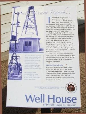
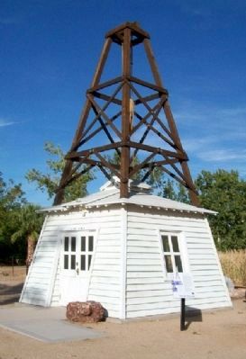
This building, which houses a groundwater well pump, is a re-creation of a Salt River Project (SRP) pump house from the 1920s. In the original pump houses, a wooden derrick was erected first and used to drill the well. Once the well was working, an electric pump was installed and the lower half of the derrick enclosed with wood siding.
The Project's first groundwater wells, drilled in 1919, pumped water into ditches for drainage into the nearest river or wash. This was done to lower the water table which had been rising as a result of irrigation and was damaging crops by bringing salts and other harmful minerals to the surface. When drought struck Arizona in the late 1920s, the Project began using the pumped water for irrigation - a practice that continues today.
As far as we know, there never was a well at this site. Usually the Project located its wells next to canals and laterals, so the pumped water could be distributed to irrigation customers.
On the Ranch Today
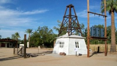
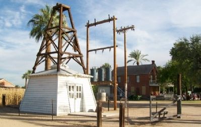
This full-scale model of an early pump house was donated by SRP and built in 2003 by SRP employees. There is no well underneath the pump, which was obtained from a well site near Yuma, and the electrical transformers are not connected to any power source.
[Photo captions follow]
[Top left] The above Phoenix-area pump house, which no longer exists, served as a model for this re-creation project. Buildings like these were once an important part of central Arizona's irrigated landscape. (Photo courtesy of the SRP Research Archives Department).
[Bottom left] SRP employees at left, re-created this well house as part of SRP's Centennial in 2003. (Sahuaro Ranch Park Historic Area photo).
Erected by Glendale Parks & Recreation.
Topics. This historical marker is listed in these topic lists: Agriculture • Industry & Commerce. A significant historical year for this entry is 1919.
Location. 33° 34.6′ N, 112° 11.333′ W. Marker is in Glendale, Arizona, in Maricopa County. Marker is about 125 feet NNW of the Foreman's House, at Sahuaro Ranch Park Historic Area. Touch for map. Marker is at or near this postal address: 9802 North 59th Avenue, Glendale AZ 85302, United States of America. Touch for directions.
Other nearby markers. At least 8 other markers are within walking distance of this marker. Dairy Barn (within shouting distance of this marker); The Barnyard (within shouting distance of this marker); Blacksmith and Machine Shop (within shouting distance of this marker); Foreman's House (within shouting distance of this marker); Stable / Granary (within shouting distance of this marker); Corrals and Tack House (about 300 feet away, measured in a direct line); Fruit Packing Shed (about 300 feet away); Water & Power (about 400 feet away). Touch for a list and map of all markers in Glendale.
Also see . . . A History of the Salt River Project. (Submitted on March 4, 2011, by William Fischer, Jr. of Scranton, Pennsylvania.)
Credits. This page was last revised on August 30, 2020. It was originally submitted on March 4, 2011, by William Fischer, Jr. of Scranton, Pennsylvania. This page has been viewed 1,186 times since then and 33 times this year. Photos: 1, 2, 3, 4. submitted on March 4, 2011, by William Fischer, Jr. of Scranton, Pennsylvania.


