Greenbelt in Prince George's County, Maryland — The American Northeast (Mid-Atlantic)
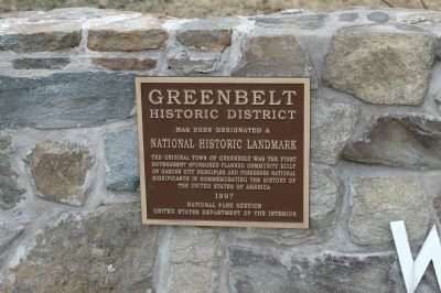
Greenbelt Historic District
Erected 1997 by National Park Service, United States Department of the Interior.
Topics and series. This historical marker is listed in these topic lists: Charity & Public Work • Settlements & Settlers. In addition, it is included in the National Historic Landmarks series list.
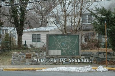
Location. 38° 59.813′ N, 76° 52.745′ W. Marker is in Greenbelt, Maryland, in Prince George's County. Marker is on Southway north of Greenbelt Road (Maryland Route 193), on the right when traveling north. Marker is on the "Welcome to Greenbelt" low stone wall at the bus stop near the entrance ramp to southbound Baltimore Washington Parkway (State Route 295). Touch for map. Marker is in this post office area: Greenbelt MD 20770, United States of America. Touch for directions.
Other nearby markers. At least 8 other markers are within walking distance of this marker. Greenbelt (here, next to this marker); Greenbelt Museum (approx. ¼ mile away); Community Center (approx. 0.3 miles away); City of Greenbelt (approx. 0.3 miles away); Eleanor Roosevelt (approx. 0.3 miles away); Swimming Pool (approx. 0.3 miles away); Roosevelt Center (approx. 0.3 miles away); Gladys Noon Spellman Trail and Overpass (approx. 0.4 miles away). Touch for a list and map of all markers in Greenbelt.
Additional keywords. New Deal
Credits. This page was last revised on January 12, 2020. It was originally submitted on March 17, 2006, by Tom Fuchs of Greenbelt, Maryland. This page has been viewed 2,022 times since then and 23 times this year. Last updated on March 28, 2011, by Richard E. Miller of Oxon Hill, Maryland. Photos: 1, 2, 3. submitted on March 17, 2006, by Tom Fuchs of Greenbelt, Maryland. • Bill Pfingsten was the editor who published this page.


