Inwood in Manhattan in New York County, New York — The American Northeast (Mid-Atlantic)
Dyckman Farmhouse Museum
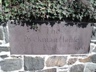
Dyckman House Park
— .545 acre —
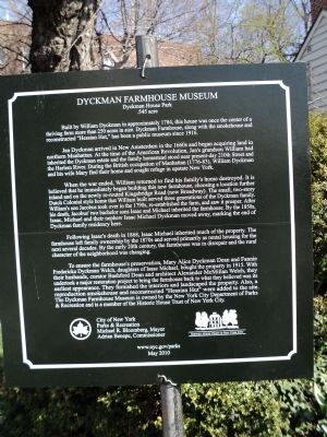
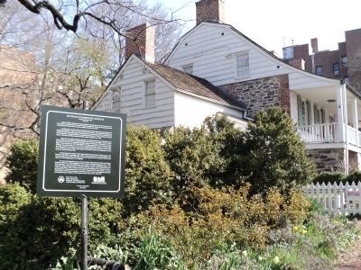
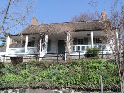
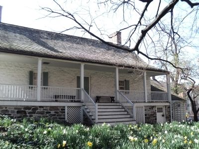
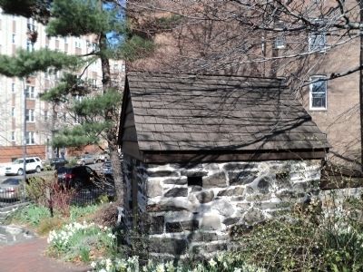
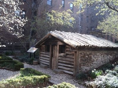
Built by William Dyckman in approximately 1784, this house was once the center of a thriving farm more than 250 acres in size. Dyckman Farmhouse, along with the smokehouse and reconstructed “Hessian Hut,” has been a public museum since 1916.
Jan Dyckman arrived in New Amsterdam in the 1660s and began acquiring land in northern Manhattan. At the time of the American Revolution, Jan’s grandson William had inherited the Dyckman estate and the family homestead stood near present-day 210th Street and the Harlem River. During the British occupation of Manhattan (1776-83), William Dyckman and his wife Mary fled their home and sought refuge in upstate New York.
When the war ended, William returned to find his family’s home destroyed. It is believed that he immediately began building this new farmhouse, choosing a location further inland and on the newly re-routed Kingsbridge Road (now Broadway). The small two-story Dutch Colonial style home that William built served three generations of the Dyckman family. William’s son Jacobus took over in the 1790s, re-established the farm, and saw it prosper. After his death, Jacobus’ two bachelor sons Isaac and Michael inherited the farmhouse. By the 1850s, Isaac, Michael and their nephew Isaac Michael Dyckman moved away, marking the end of Dyckman family residency here.
Following Isaac’s death in 1868, Isaac Michael inherited much of the property. The farmhouse left family ownership by the 1870s and served primarily as rental housing for the next several decades. By the early 20th century, the farmhouse was in disrepair and the rural character of the neighborhood was changing.
To ensure the farmhouse’s preservation, Mary Alice Dyckman Dean and Fannie Fredericka Welch, daughters of Isaac Michael, bought the property in 1915. With their husbands, curator Bashford Dean and architect Alexander McMillian Welch, they undertook a major restoration project to bring the farmhouse back to what they believed was its earliest appearance. They furnished the interiors and landscaped the property. Also, a reproduction smokehouse and reconstructed “Hessian Hut” were added to the site. The Dyckman Farmhouse Museum is owned by the New York City Department of Parks & Recreation and is a member of the Historic House trust of New York City.
Erected 2010 by City of New York Department of Parks and Recreation.
Topics. This historical marker is listed in these topic lists: Colonial Era • Notable Buildings • War, US Revolutionary. A significant historical year for this entry is 1784.
Location. 40° 52.036′ N, 73° 55.38′ W. Marker is in Manhattan, New York, in New York County. It is in Inwood. Marker is at the intersection of Broadway (U.S. 9) and 204th Street, on the left when traveling north on Broadway. Touch for map. Marker is at or near this postal address: 4881 Broadway, New York NY 10034, United States of America. Touch for directions.
Other nearby markers. At least 8 other markers are within walking distance of this marker. The Military Hut (within shouting distance of this marker); The Hessian Military Hut (within shouting distance of this marker); Shorakkopoch (approx. 0.4 miles away); Fort Tryon (approx. 0.6 miles away); Fort Tryon Park (approx. 0.7 miles away); Margaret Cochran Corbin (approx. 0.8 miles away); Colonel William Baxter (approx. 0.8 miles away); Carolina Baptist Church (approx. 0.9 miles away). Touch for a list and map of all markers in Manhattan.
Also see . . . Dyckman Farmhouse Museum. Official NYC Parks description. (Submitted on April 8, 2020, by Larry Gertner of New York, New York.)
Credits. This page was last revised on January 31, 2023. It was originally submitted on April 10, 2011, by Bill Coughlin of Woodland Park, New Jersey. This page has been viewed 995 times since then and 15 times this year. Photos: 1, 2, 3, 4, 5, 6, 7. submitted on April 10, 2011, by Bill Coughlin of Woodland Park, New Jersey.
