Springfield in Greene County, Missouri — The American Midwest (Upper Plains)
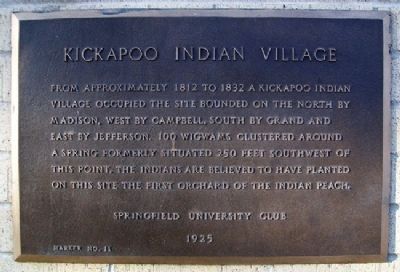
Kickapoo Indian Village
From approximately 1812 to 1832 a Kickapoo Indian village occupied the site bounded on the north by Madison, west by Campbell, south by Grand and east by Jefferson. 100 wigwams clustered around a spring formerly situated 250 feet southwest of this point. The Indians are believed to have planted on this site the first orchard of the Indian peach.
Erected 1925 by Springfield University Club. (Marker Number 11.)
Topics. This historical marker is listed in this topic list: Native Americans. A significant historical year for this entry is 1812.
Location. 37° 12.019′ N, 93° 17.526′ W. Marker is in Springfield, Missouri, in Greene County. Marker is at the intersection of Madison Street and South Avenue, on the right when traveling west on Madison Street. Marker is on the south wall of South Tower public housing. Touch for map. Marker is at or near this postal address: 770 South Avenue, Springfield MO 65806, United States of America. Touch for directions.
Other nearby markers. At least 8 other markers are within walking distance of this marker. Battle of Springfield (approx. 0.2 miles away); a different marker also named Battle of Springfield (approx. 0.2 miles away); The Day House (approx. 0.2 miles away); a different marker also named Battle of Springfield (approx. 0.2 miles away); a different marker also named Battle of Springfield (approx. ¼ mile away); a different marker also named Battle of Springfield (approx. ¼ mile away); Maple Park Gazebo (approx. 0.3 miles away); Wilshire Apartments (approx. 0.3 miles away). Touch for a list and map of all markers in Springfield.
Also see . . .
1. Kickapoo Indian Village Marker. Springfield-Greene County Library District website entry (Submitted on June 5, 2011, by William Fischer, Jr. of Scranton, Pennsylvania.)
2. Native Languages of the Americas: Kickapoo. North American Indian Tribes website entry (Submitted on June 5, 2011, by William Fischer, Jr. of Scranton, Pennsylvania.)
3. Kickapoo High School, Springfield MO. School website homepage (Submitted on June 5, 2011, by William Fischer, Jr. of Scranton, Pennsylvania.)
Credits. This page was last revised on April 2, 2022. It was originally submitted on June 5, 2011, by William Fischer, Jr. of Scranton, Pennsylvania. This page has been viewed 1,051 times since then and 21 times this year. Photos: 1, 2. submitted on June 5, 2011, by William Fischer, Jr. of Scranton, Pennsylvania.

