Near Brandy Station in Culpeper County, Virginia — The American South (Mid-Atlantic)
The Battle of Brandy Station
Charging the Confederate Guns
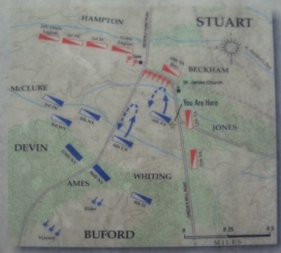
Buford decided to test the strength of the Confederate position near St. James Church. He ordered forward several regiments of his Reserve Brigade: the 6th Pennsylvania Cavalry (only 5 companies strong), the 6th U.S. Cavalry, and the 2nd U.S. Cavalry. Gen. Pleasonton, however, diverted the 2nd for another mission before the 6th Pennsylvania charged.
"Never rode troopers more gallantly," wrote a Confederate artillery captain whose battery opened fire on the Union troopers as they crossed the field. Sabers flashed in the sun, cannon roared, and thousands of hooves pounded the grass. The Confederates poured cannister and carbine fire into the ranks of the Pennsylvanians as mounted Southerners waited behind the line of cannon. With textbook discipline and uncommon valor, the Union regiment surged across the open ground towards 16 Confederate fieldpieces.
The Pennsylvanians penetrated the line of guns but were repulsed by the waiting Confederate cavalry. The Federal horsemen retired to their original position "as they came, with ranks well closed up," noted an admiring Confederate. Nonetheless, after years of criticism, the Union cavalry had finally displayed the skill and discipline needed to match their Southern opponents.
Buford realized his foes at St. James Church were strongly posted. He left four cavalry and two infantry regiments behind to hold against Confederate attacks and to guard the vital crossing at Beverly Ford. He then swung his remaining men northward to work around the Confederate left flank. The Union force would soon meet opposition again on the fields of the Cunningham and Green Farms.
Help Preserve Battlefields • call CWPT at 1-888-606-1400 • www.civilwar.org • The Hallowell Foundation generously contributed toward the interpretation of this site in memory of Carrington Williams.
This material is based upon work assisted by a grant from the Department of the Interior, National Park Service. Any opinion, findings and conclusions or recommendations expressed in this material are those of the author(s) and do not necessarily reflect the views of the Department of the Interior.
Erected by Civil War Preservation Trust.
Topics. This historical marker is listed in this topic list: War, US Civil. A significant historical date for this entry is June 9, 1863.
Location.
Other nearby markers. At least 8 other markers are within walking distance of this marker. The 1863-64 Winter Encampment (about 600 feet away, measured in a direct line); a different marker also named The Battle of Brandy Station (approx. ¼ mile away); St. James Episcopal Church (approx. 0.4 miles away); a different marker also named Battle of Brandy Station (approx. 0.4 miles away); a different marker also named The 1863-64 Winter Encampment (approx. 0.4 miles away); a different marker also named Battle of Brandy Station (approx. half a mile away); Lee's Forgotten Warrior (approx. half a mile away); a different marker also named The Battle of Brandy Station (approx. 0.6 miles away). Touch for a list and map of all markers in Brandy Station.
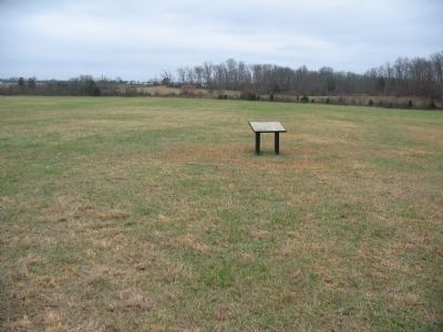
More about this marker. On the lower left is "Eyewitness Alfred Waud's drawing of a cavalry charge at Brandy Station from the July 4, 1863 issue of Harper's Weekly." On the upper right is a map depicting the maneuvers described in the text.
Regarding The Battle of Brandy Station. This is one of several markers interpreting the Battle of Brandy Station and the winter encampments of 1863-64 in Culpeper County. See the Battle of Brandy Station Virtual Tour by Markers linked below for additional related markers.
Also see . . .
1. The Battle of Brandy Station. An article from The Brandy Station Foundation. (Submitted on December 24, 2007, by Craig Swain of Leesburg, Virginia.)
2. Battle of Brandy Station. National Park Service summary of the battle and tour guide. (Submitted on December 24, 2007, by Craig Swain of Leesburg, Virginia.)
3. Rush's Lancers. The 6th Pennsylvania was also called Rush's Lancers. Early in the war, the unit was armed with long lances instead of firearms. After gaining a reputation as a skilled scouting force, the Lancers were re-armed with carbines and consolidated with Buford's Cavalry Division. After Brandy Station, the Lancers went on to serve through the war in most of the major battles and campaigns. (Submitted on December 24, 2007, by Craig Swain of Leesburg, Virginia.)
4. Brandy Station. Civil War Preservation Trust page on the battle. (Submitted on December 30, 2007, by Craig Swain of Leesburg, Virginia.)
5. Battle of Brandy Station Virtual Tour by Markers. A set markers that document the Battle of Brandy Station, June 9, 1863, and the Winter Encampment of 1863-64. Note the order of appearance is geographic and not chronologically aligned to the battle. (Submitted on January 1, 2008, by Craig Swain of Leesburg, Virginia.)
Photographed By Craig Swain, December 22, 2007
5. Direction of the Charge
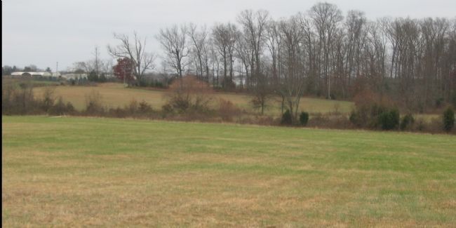
The objective of the 6th Pennsylvania Cavalry was a line of Confederate artillery positioned along the St. James Church Road, which runs along the edge of the woods in the distant center. To reach that location, the troopers had to traverse the low ground seen here, crossing a creek, and then up the rise on the other side.
Photographed By Craig Swain, December 22, 2007
6. Federal Lines
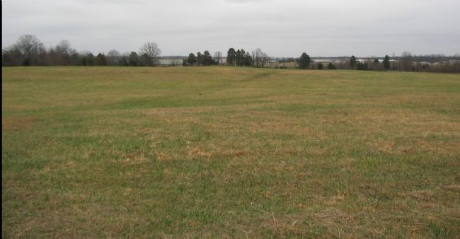
Looking to the east from the starting line of the 6th Pennsylvania Charge, the modern airport stands in the distance. In that vicinity, Devin's Federal cavalry were arrayed. To the rear of the 6th Pennsylvania, and to the left side of this photo, was Gen. Ames' Infantry forming the center of the Federal lines at this point.
Credits. This page was last revised on August 3, 2022. It was originally submitted on December 24, 2007, by Craig Swain of Leesburg, Virginia. This page has been viewed 2,217 times since then and 23 times this year. Last updated on August 1, 2022, by Carl Gordon Moore Jr. of North East, Maryland. Photos: 1. submitted on December 24, 2007, by Craig Swain of Leesburg, Virginia. 2. submitted on March 13, 2009, by Craig Swain of Leesburg, Virginia. 3, 4, 5, 6. submitted on December 24, 2007, by Craig Swain of Leesburg, Virginia. • Bernard Fisher was the editor who published this page.

