West Liberty in Logan County, Ohio — The American Midwest (Great Lakes)
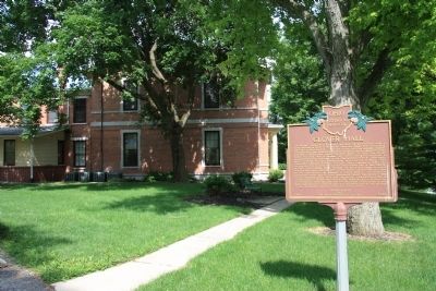
West Liberty / Glover Hall
Inscription.
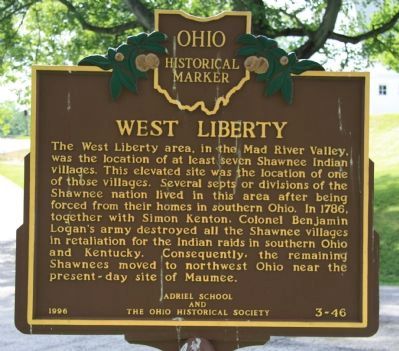
[Front Side of Marker]: "West Liberty"
The West Liberty area, in the Mad River Valley, was the location of at least seven Shawnee Indian villages. This elevated site was the location of one of those villages. Several septs or divisions of the Shawnee nation lived in this area after being forced from their homes in southern Ohio. In 1786, together with Simon Kenton, Colonel Benjamin Logan's army destroyed all the Shawnee villages in retaliation for the Indian raids in southern Ohio and Kentucky. Consequently, the remaining Shawnees moved to northwest Ohio near the present-day site of Maumee.
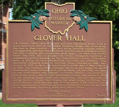
[Back Side of Marker]: "Glover Hall"
J.M. Glover, owner of a local sawmill and dry goods store, built a brick mansion in 1853 on the former Shawnee village site overlooking the town of West Liberty. The two-story building displays elegant craftsmanship and features decorative brackets, stone window surrounds and belt coursings, and projecting gable bays. In 1894, the Glover home was sold, and it became the Glover Collegiate Institute, a preparatory school operated by the Presbyterian Church. Five years later, a group of local Mennonites acquired the building. The Mennonite Orphan's home of Orrville, Ohio, founded in 1896, was invited in 1900 to move its operations to Glover Hall in West Liberty. In 1957, the Orphan's Home changed its focus and began to serve families who have children with special needs. At that time, the name of the organization was changed to Adriel School. An outpatient counseling center, Ben-El Child Development Center, was added in 1989 to the existing foster care and residential treatment services of Adriel School. Glover Hall houses the administrative offices for Adriel School. Over the past one hundred years, 3,951 children and their families have received care and treatment through the services of the Mennonite Orphan's Home and Adriel School.
Erected 1996 by Adriel School and The Ohio Historical Society. (Marker Number 3-46.)
Topics and series. This historical marker is listed in these topic lists: Charity & Public Work • Churches & Religion • Settlements & Settlers • Wars, US Indian. In addition, it is included in the Ohio Historical Society / The Ohio History Connection series list. A significant historical year for this entry is 1786.
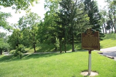
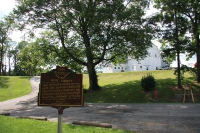
Location. 40° 15.354′ N, 83° 45.51′ W. Marker is in West Liberty, Ohio, in Logan County. Marker can be reached from North Detroit Street (County Route 189) north of U.S. 68, on the left when traveling north. This historical marker is located well off the road, on the grounds of the Adriel School
campus. To view the historical marker, take the southern most campus driveway that leads up a hill to the administrative buildings of the school. You will find the historical marker behind the "Glover Hall" building. Touch for map. Marker is in this post office area: West Liberty OH 43357, United States of America. Touch for directions.
Other nearby markers. At least 8 other markers are within walking distance of this marker. West Liberty World War I Memorial (about 700 feet away, measured in a direct line); Shawnee Nation in Logan County / Shawnee Villages in Logan County (about 700 feet away); Michael Lane Partin (about 800 feet away); Hull's Trace / Moluntha (approx. 0.2 miles away); Sherman M. Ricketts (approx. 0.2 miles away); West Liberty Veterans Memorial (approx. ¼ mile away); Foust Addition (approx. 0.4 miles away); West Liberty Lion's Club Park (approx. 0.6 miles away). Touch for a list and map of all markers in West Liberty.
Credits. This page was last revised on June 16, 2016. It was originally submitted on June 28, 2011, by Dale K. Benington of Toledo, Ohio. This page has been viewed 966 times since then and 28 times this year. Photos: 1, 2, 3, 4, 5. submitted on June 28, 2011, by Dale K. Benington of Toledo, Ohio.
