Blackwater in Cooper County, Missouri — The American Midwest (Upper Plains)
Osage Chieftain
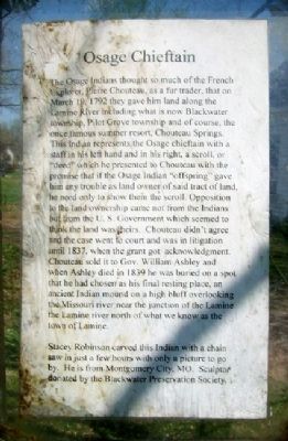
The Osage Indians thought so much of the French Explorer, Pierre Chouteau, as a fur trader, that on March 19, 1792 they gave him land along the Lamine River including what is now Blackwater township, Pilot Grove township and of course, the once famous summer resort, Chouteau Springs.
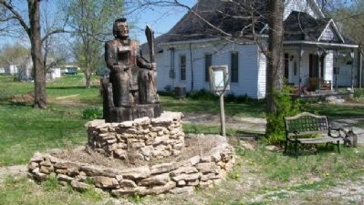
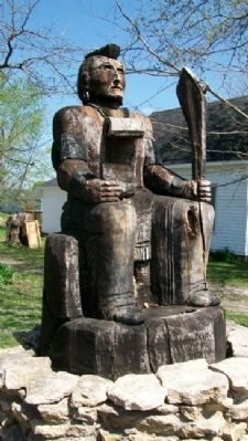
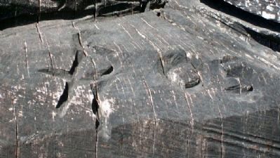
This Indian represents the Osage chieftain with a staff in his left hand and in his right, a scroll, or "deed" which he presented to Chouteau with the promise that if the Osage Indian "offspring" gave him any trouble as land owner of said tract of land, he need only to show them the scroll. Opposition to the land ownership came not from the Indians but from the U.S. Government which seemed to think the land was theirs. Chouteau didn't agree and the case went to court and was in litigation until 1837, when the grant got acknowledgment. Chouteau sold it to Gov. William Ashley and when Ashley died in 1839 he was buried on a spot that he had chosen as his final resting place, an ancient Indian mound on a high bluff overlooking the Missouri river near the junction of the Lamine [sic] river north of what we know as the town of Lamine.
Stacey Robinson carved this Indian with a chain saw in just a few hours with only a picture to go by. He is from Montgomery City, MO. Sculptor donated by the Blackwater Preservation Society.
Erected 2003 by Blackwater Preservation Society.
Topics. This historical marker is listed in these topic lists: Native Americans • Settlements & Settlers. A significant historical month for this entry is March 1860.
Location. 38° 58.764′ N, 92° 59.602′ W. Marker is in Blackwater, Missouri, in Cooper County. Marker is at the intersection of Main Street (Missouri Route K) and Davis Avenue, on the left when traveling east on Main Street. Touch for map. Marker is at or near this postal address: 308 Main Street, Blackwater MO 65322, United States of America. Touch for directions.
Other nearby markers. At least 8 other markers are within 15 miles of this marker, measured as the crow flies. Blackwater Veterans Memorial (about 300 feet away, measured in a direct line); Replica of The Statue of Liberty (approx. 13.8 miles away); POW MIA (approx. 14.6 miles away); Chief Justice John Marshall (approx. 14.6 miles away); Revolutionary Soldiers in Saline County, Missouri (approx. 14.7 miles away); Greater Love Hath No Man Than This - (approx. 14.7 miles away); WWI Soldier (approx. 14.7 miles away); Santa Fe Trail (approx. 14.7 miles away).
Also see . . .
1. The Osage Nation. Tribe website homepage (Submitted on July 3, 2011, by William Fischer, Jr. of Scranton, Pennsylvania.)
2. Pierre Chouteau, Jr. – Merchant and Fur Trader. Legends of America website entry (Submitted on July 3, 2011, by William Fischer, Jr. of Scranton, Pennsylvania.)
Credits. This page was last revised on March 1, 2022. It was originally submitted on July 3, 2011, by William Fischer, Jr. of Scranton, Pennsylvania. This page has been viewed 866 times since then and 33 times this year. Photos: 1, 2, 3. submitted on July 3, 2011, by William Fischer, Jr. of Scranton, Pennsylvania. 4. submitted on July 4, 2011, by William Fischer, Jr. of Scranton, Pennsylvania.


