Plymouth in Amador County, California — The American West (Pacific Coastal)
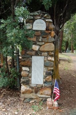
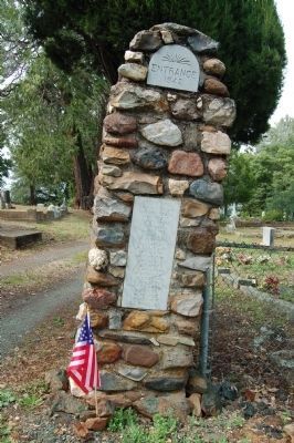
Memorial Entrance
1942
[Left Pillar:]
W.H. Pritchard A. Kretcher J.R. Hyland T. Trelese B. Packard R. Pew C.P. Sevey L.E. Walton L. Jack T. Pinder J.A. Doherty
[Right Pillar:]
Dr. R.H. Dungan Marvin Brace Mat Brace F.M. Purtom L. Hank S.G. Lewis J.J. Ekel N. Hinlson A. Geisler R Claiborn W. Dickin W. Pearson J.F. McGee R. Gilmore J. C. Williams N. Ventich W. Hooper T Shearer H.M. Richards R. Dillon W. Telker M. Wagner S.C. Wheeler
Erected 1942.
Topics. This historical marker is listed in these topic lists: Cemeteries & Burial Sites • War, World I.
Location. 38° 28.928′ N, 120° 50.975′ W. Marker is in Plymouth, California, in Amador County. Marker is on Church Street north of Main Street. Touch for map. Marker is in this post office area: Plymouth CA 95669, United States of America. Touch for directions.
Other nearby markers. At least 8 other markers are within 3 miles of this marker, measured as the crow flies. Wheeler Building (about 500 feet away, measured in a direct line); The Arcade Bar (about 600 feet away); City of Plymouth (about 800 feet away); Chinese Store (approx. 0.2 miles away); Benny Brown Arena (approx. 0.4 miles away); Plymouth Consolidated Mines (approx. 0.4 miles away); Drytown (approx. 2.8 miles away); Salute to Early Amador Miners (approx. 2.8 miles away). Touch for a list and map of all markers in Plymouth.
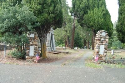
More about this marker. The Memorial Entrance is located at the top of Church Street. Contrary to Google Maps this is the St. Mary's of the Mountain Catholic Cemetery, not a Protestant cemetery.
Credits. This page was last revised on June 16, 2016. It was originally submitted on July 4, 2011, by Barry Swackhamer of Brentwood, California. This page has been viewed 752 times since then and 19 times this year. Photos: 1, 2, 3. submitted on July 4, 2011, by Barry Swackhamer of Brentwood, California. • Syd Whittle was the editor who published this page.


