Reno in Washoe County, Nevada — The American Mountains (Southwest)
The Truckee River
Inscription.
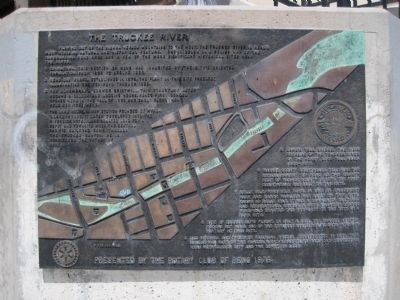
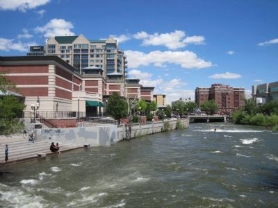
Flowing out of the Sierra Nevada Mountains to the west, the Truckee River is Reno’s most striking natural and historical feature. Shown below on a relief map of the surrounding Reno area are a few of the more significant historical sites near the river.
1 Chinatown. This section of Reno was inhabited by the city’s oriental population from 1869 to around 1920.
2 Reno Gas Works. Established in 1878, the plant on this site produced illuminating gas for Reno through 1890.
3 The Alhambra. A former gristmill, this structure later became a saloon and lodging house. Reno’s first school opened here in the Fall of 1868 and early clergymen held services here.
4 The Lake House. A way station founded by Myron C. Lake in 1862. It later developed into the Riverside Hotel. Lake donated land for a depot and townsite when the Central Pacific Railroad came through the Truckee Canyon. He is considered the Father of Reno.
5 Lake’s Toll Bridge. The main crossing of the Truckee River on the Honey Lake Toll Road, 1862-1877.
6 Washoo County Courthouse. Following the established of Reno as the county seat of Washoe County in 1871, the first courthouse was built on this site.
7 Belle Isle/Wingfield Park. In 1911 an amusement park and dance pavilion was built on this site. Known as Belle Isle, it was a community cultural and recreational center, in 1920, financier George Wingfield donated the property to the city as a park site.
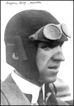
8 Site of Eugene Ely’s Flight. On July 4, 1911, the famous aviator Eugene Ely make one of the earliest exhibition flights in Reno’s history at this site.
9 Old Virginia and Truckee Railroad Bridge. Constructed in 1871, this bride was part of the famous V and T Shortline Railroad connecting Reno with Carson City and the Comstock Lode.
Erected 1979 by Rotary Club of Reno.
Topics and series. This historical marker is listed in these topic lists: Industry & Commerce • Settlements & Settlers • Waterways & Vessels. In addition, it is included in the Rotary International series list. A significant historical month for this entry is July 1836.
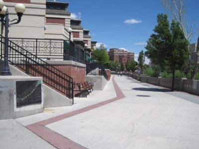
Location. 39° 31.486′ N, 119° 48.92′ W. Marker is in Reno, Nevada, in Washoe County. Marker can be reached from Truckee River Lane near West Street. The marker is located at a plaza on the north side of the river. Foot traffic only. Touch for map. Marker is at or near this postal address: 175-187 Trucke River Lane, Reno NV 89501, United States of America. Touch for directions.
Other nearby markers. At least 8 other markers are within walking distance of this marker. Reno's Beginning (about 300 feet away, measured in a direct line); The Virginia Street Bridges (about 700 feet away); Lake's Crossing (approx. 0.2 miles away); Lake Mansion (approx. 0.2 miles away); Ginsburg Jewelry Company (approx. 0.2 miles away); Site of Nevada’s First Public Library (approx. 0.2 miles away); Frederick Joseph DeLongechamps (approx. 0.2 miles away); The Humboldt Trail (approx. 0.2 miles away). Touch for a list and map of all markers in Reno.
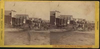
Regarding The Truckee River. "Reno's history began when Charles William Fuller arrived in the Truckee Meadows in 1859 and occupied a piece of land on the south bank of the Truckee River. By early 1860, he had constructed a bridge and small hotel, and the place was known as Fuller's Crossing. In the following year, Fuller sold his bridge and hotel to Myron C. Lake, who renamed the spot Lake's Crossing and soon was charging a toll on the bridge. The Crossing became an important station on one of the main routes between northern California and the silver mines of Virginia City and the Comstock Lode.
Lake was the crossing's only property owner until the Central Pacific Railroad (later renamed Union Railroad) crossed the Sierra Nevada in 1868 and pushed its tracks into the Truckee Meadows. Under terms of an agreement between Myron Lake and Central Pacific, a new town was laid out at the crossing; ownership was divided between Lake and the railroad. Almost overnight, buildings began to appear on the town site and the new settlement was named Reno in honor of General Jesse Lee Reno (1823–1862), a Union army officer who was killed during the Civil War.
In 1871, the Nevada State Legislature moved the Washoe County seat to Reno, where one year later the Virginia & Truckee Railroad extended its line. The town soon became an important commercial center on the transcontinental railroad and a transfer point for the immense wealth coming out of the Comstock Lode. The University of Nevada was moved from Elko to Reno in 1885."
Source: City.Data.com - http://www.city-data.com/us-cities/The-West/Reno-History.html
Also see . . .
1. Myron C. Lake. Find-A-Grave posting offers a biography of Myron C. Lake along with historical photos. He is buried at Mt. View Cemetery, Reno, Nevada. (Submitted on July 9, 2011.)
2. Washoe County Courthouse. The current courthouse building is the third courthouse of Washoe County. The original Reno courthouse, built of red brick in 1871-1873, still stands as an internal component of the building we see today. (Submitted on July 9, 2011.)
3. Eugene Ely. Known as the National Guard's first aviator. (Submitted on July 9, 2011.)
4. The V & T Inyo Crossing the Bridge. This photo, circa 1906, is of the V & T's Inyo crossing the Truckee River in Reno. (Submitted on July 9, 2011.)
5. The Central Pacific Photographic Histoy Museum. (Submitted on July 10, 2011, by Barry Swackhamer of Brentwood, California.)
Additional keywords. California Trail
Credits. This page was last revised on June 16, 2016. It was originally submitted on July 5, 2011, by Barry Swackhamer of Brentwood, California. This page has been viewed 904 times since then and 20 times this year. Photos: 1, 2, 3. submitted on July 5, 2011, by Barry Swackhamer of Brentwood, California. 4. submitted on July 9, 2011. 5. submitted on July 10, 2011, by Barry Swackhamer of Brentwood, California. • Syd Whittle was the editor who published this page.
