Mammoth in Yellowstone National Park in Park County, Wyoming — The American West (Mountains)
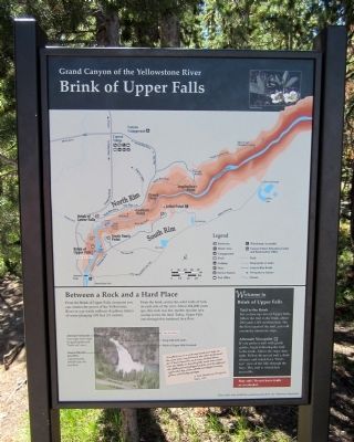
Brink of Upper Falls
Grand Canyon of the Yellowstone River
Between a Rock and a Hard Place
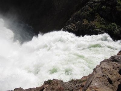
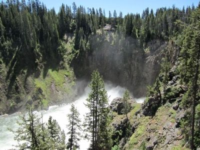
From the Brink of Upper Falls viewpoint you can witness the power of the Yellowstone River as you watch millions of gallons (liters) of water plunging 109 feet (33 meters).
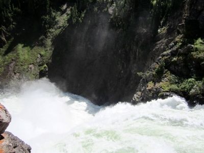
From the brink, notice the solid walls of rock on each side of the river. About 484,000 years ago, this rock was hot, molten rhyolite lava oozing across the land. Today, Upper Falls cuts through this hardened lava flow.
Welcome to Brink of Upper Falls
Trail to the Brink
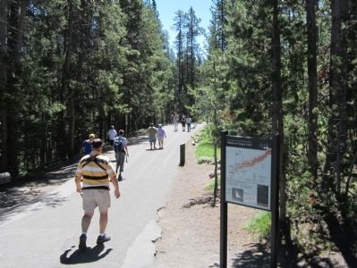
For a close-up view of Upper falls, follow the trail to the brink, abut 200 yards (183 m) from here. On the lower part of the trail, you will encounter numerous steps.
Alternate Viewpoint
If you prefer a trail with gentle grades, begin following the trail to the brink. Above the steps, turn right. Follow the paved trail a short distance and watch for a “birdís eye” view of the falls through the trees. This trail is wheelchair accessible.
Stay safe! Do not leave trails or overlooks!
(sidebar)
I walked out on a rock and made two steps at the same time, one forward, the other backward, for I had unawares, as it were, looked down into the depths or bowels of the earth into which the Yellow[stone] plunged as if to cool the infernal region that lay under all this wonderful country of lava and boiling springs.
A. Bart Henderson, Prospector
Diary, 1867
This exhibit made possible by a generous grant from The Yellowstone Association
Erected by The Yellowstone Association.
Topics. This historical marker is listed in this topic list: Natural Features. A significant historical year for this entry is 1867.
Location. 44° 42.847′ N, 110° 30.036′ W. Marker is in Yellowstone National Park, Wyoming, in Park County. It is in Mammoth. Marker can be reached from Brink of Upper Falls Turnout, 0.3 miles east of Grand Loop Road. Touch for map. Marker is in this post office area: Yellowstone National Park WY 82190, United States of America. Touch for directions.
Other nearby markers. At least 8 other markers are within walking distance of this marker. Upper Falls of the Yellowstone River (about 700 feet away, measured in a direct line); Uncle Tomís Point (approx. ľ mile away); Geologic Junction (approx. ľ mile away); Uncle Tomís Trail (approx. 0.3 miles away); Brink of Lower Falls (approx. 0.4 miles away); Chittenden Memorial Bridge (approx. 0.4 miles away); Still Venting After All These Years (approx. half a mile away); Waterfall Makers (approx. ĺ mile away). Touch for a list and map of all markers in Yellowstone National Park.
More about this marker. On the lower left is a "You Are Here" map indicating:
Alternate Viewpoint (turn right above steps for gentle grades and “birdís eye view”), Canyon Rhyolite Lava Flow (approximately 484,000 year-old lava flow), Steep trail with stairs, and Brink of Upper Falls Overlook.
Also see . . . Yellowstone National Park. National Park Service (Submitted on July 30, 2011.)
Credits. This page was last revised on February 16, 2023. It was originally submitted on July 30, 2011, by Bernard Fisher of Richmond, Virginia. This page has been viewed 741 times since then and 17 times this year. Photos: 1, 2, 3, 4, 5. submitted on July 30, 2011, by Bernard Fisher of Richmond, Virginia.
