Mammoth in Yellowstone National Park in Park County, Wyoming — The American West (Mountains)
Lookout Point
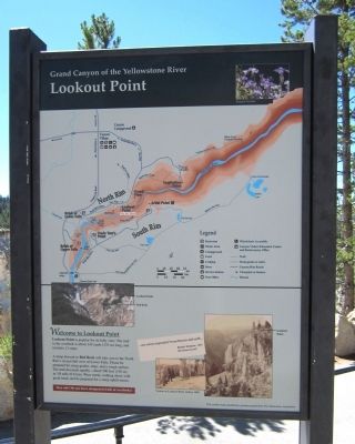
Grand Canyon of the Yellowstone River
Welcome to Lookout Point
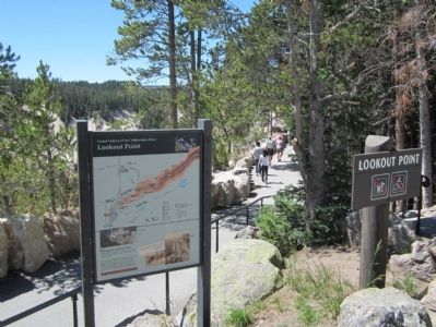
Lookout Point is popular for its lofty view. The trail to the overlook is about 145 yards (133 m) long, and includes 13 steps.
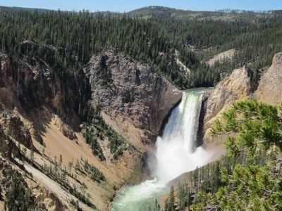
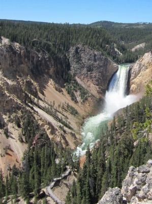
A steep descent to Red Rock will take you to the North Rim's closest full view of Lower Falls. Please be prepared for steep grades, steps, and a rough surface. The trail descends rapidly—about 500 feet (150 m) in 3/8 mile (0.6 km). Wear sturdy walking shoes with good tread, and be prepared for a steep uphill return.
Stay safe! Do not leave trails or overlooks!
(sidebar)
...one seems suspended 'tween heaven and earth...
Robert Strahorn, 1881
Enchanted Land
This exhibit made possible by a generous grant from The Yellowstone Association
Erected by The Yellowstone Association.
Topics. This historical marker is listed in this topic list: Natural Features. A significant historical year for this entry is 1881.
Location. 44° 43.287′ N, 110° 29.281′ W. Marker is in Yellowstone National Park, Wyoming, in Park County. It is in Mammoth. Marker is on North Rim Drive, 0.7 miles east of Grand Loop Road. Touch for map. Marker is in this post office area: Yellowstone National Park WY 82190, United States of America. Touch for directions.
Other nearby markers. At least 8 other markers are within walking distance of this marker. Waterfall Makers (within shouting distance of this marker); Grand View (approx. 0.2 miles away); The Grand Canyon Of The Yellowstone (approx. 0.2 miles away); Still Venting After All These Years (approx. 0.4 miles away); Artist Point (approx. 0.4 miles away); The Grand Canyon of the Yellowstone (approx. 0.4 miles away); Canyon Colors (approx. 0.4 miles away); Brink of Lower Falls (approx. half a mile away). Touch for a list and map of all markers in Yellowstone National Park.
More about this marker. On the lower right are photos of "Visitors at Lookout Point, before 1890".
Also see . . . Yellowstone National Park. National Park Service (Submitted on July 31, 2011, by Bernard Fisher of Richmond, Virginia.)
Credits. This page was last revised on February 16, 2023. It was originally submitted on July 30, 2011, by Bernard Fisher of Richmond, Virginia. This page has been viewed 804 times since then and 48 times this year. Photos: 1, 2, 3. submitted on July 30, 2011, by Bernard Fisher of Richmond, Virginia. 4. submitted on July 31, 2011, by Bernard Fisher of Richmond, Virginia.


