Omaha in Stewart County, Georgia — The American South (South Atlantic)
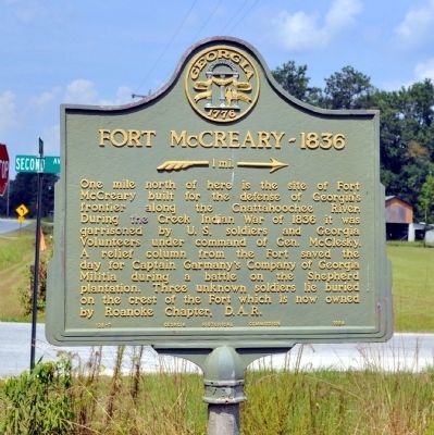
Fort McCreary – 1836
→ 1 mi. →
Erected 1954 by Georgia Historical Commission. (Marker Number 128-7.)
Topics and series. This historical marker is listed in these topic lists: Forts and Castles • Wars, US Indian. In addition, it is included in the Georgia Historical Society series list. A significant historical year for this entry is 1836.
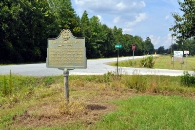
Location. 32° 8.588′ N, 85° 0.804′ W. Marker is in Omaha, Georgia, in Stewart County. Marker is at the intersection of Florence Road (Georgia Route 39) and 2nd Avenue, on the right when traveling west on Florence Road. Touch for map. Marker is in this post office area: Omaha GA 31821, United States of America. Touch for directions.
Other nearby markers. At least 8 other markers are within 9 miles of this marker, measured as the crow flies. Indian Trail (approx. 2.6 miles away); Battle of Shepherd’s Plantation (approx. 3 miles away); Florence (approx. 4.1 miles away); Spanish Fort, 1689-1691 (approx. 5.4 miles away in Alabama); Fort Jones (approx. 5.9 miles away); Providence United Methodist Church (approx. 7.8 miles away); Rev. David Walker Lowe (approx. 8.2 miles away); Macedonia Missionary Baptist Church / Macedonia School (approx. 9 miles away in Alabama). Touch for a list and map of all markers in Omaha.
Credits. This page was last revised on June 16, 2016. It was originally submitted on August 20, 2011, by David Seibert of Sandy Springs, Georgia. This page has been viewed 1,041 times since then and 48 times this year. Photos: 1, 2. submitted on August 20, 2011, by David Seibert of Sandy Springs, Georgia. • Bill Pfingsten was the editor who published this page.

