Near Covington in Alleghany County, Virginia — The American South (Mid-Atlantic)
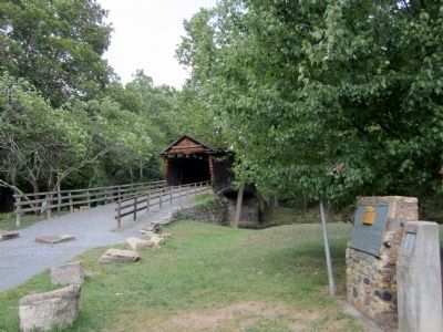
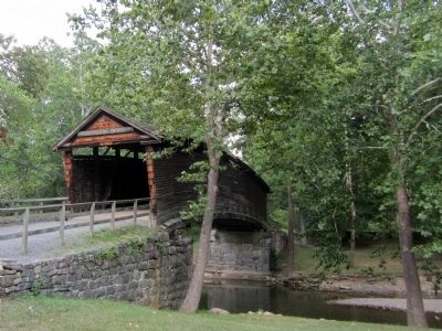
Humpback Bridge

Photographed By Bernard Fisher, August 18, 2011
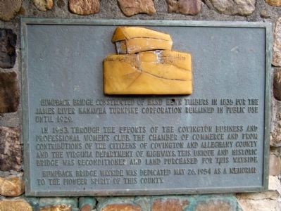
1. Humpback Bridge Marker
Humpback Bridge - Virginia's Oldest Covered Bridge
Virginia Department of Transportation website entry
Click for more information.
Virginia Department of Transportation website entry
Click for more information.
Humpback Bridge constructed of hand hewn timbers in 1835 for the James River Kanawha Turnpike Corporation remained in public use until 1929.
In 1953, through the efforts of the Covington Business and Professional Women's Club, the Chamber of Commerce and from contributions of the citizens of Covington and Alleghany County and the Virginia Department of Highways, this unique and historic bridge was reconditioned and land purchased for this wayside.
Humpback Bridge Wayside was dedicated May 26, 1954 as a memorial to the pioneer spirit of this county.
Topics. This historical marker is listed in these topic lists: Bridges & Viaducts • Roads & Vehicles. A significant historical date for this entry is May 26, 1818.
Location. 37° 48.022′ N, 80° 2.843′ W. Marker is near Covington, Virginia, in Alleghany County. Marker can be reached from Rumsey Road (Virginia Route 600) 0.1 miles south of Midland Trail (U.S. 60), on the left when traveling south. Located at the Humpback Bridge Wayside. Touch for map. Marker is in this post office area: Covington VA 24426, United States of America. Touch for directions.
Other nearby markers. At least 8 other markers are within 8 miles of this marker, measured as the crow flies. Alleghany County Confederate Soldiers Monument (approx. 2.9 miles away); Alleghany's Heroic Dead. (approx. 2.9 miles away); Alleghany's Heroic Dead (approx. 2.9 miles away); a different marker also named Alleghany's Heroic Dead (approx. 2.9 miles away); Fort Young (approx. 3˝ miles away); Averell’s Salem Raid (approx. 4.8 miles away); The Road to the Kanawha (approx. 5.9 miles away); Falling Spring Falls (approx. 7.2 miles away). Touch for a list and map of all markers in Covington.
Also see . . . Humpback Bridge. Virginia Department of Historic Resources website entry (Submitted on August 22, 2011.)
Credits. This page was last revised on December 18, 2023. It was originally submitted on August 22, 2011, by Bernard Fisher of Richmond, Virginia. This page has been viewed 738 times since then and 24 times this year. Photos: 1, 2, 3. submitted on August 22, 2011, by Bernard Fisher of Richmond, Virginia.

